RTK GNSS for Robotics: Getting Real 1-2 cm Accuracy
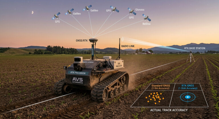
RTK GPS for Robotics: Getting Real 1-2 cm Accuracy If you are building an outdoor robot, standard GPS is often not accurate enough. A typical GPS receiver can have a position error of 1-10 meters. This may cause the robot to miss waypoints, drive outside its working area, or collect inaccurate data. Modern GNSS receivers with RTK (Real-Time Kinematic) corrections can improve positioning accuracy from a few meters to just