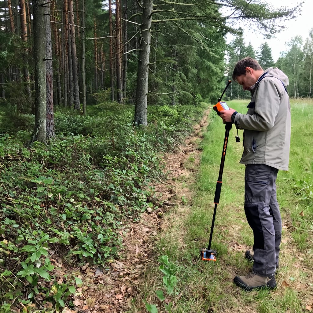
 Establishing or verifying the legal boundaries of a forest property is one of the most demanding surveying tasks in the sector. Property corners hidden under decades of undergrowth must be located with millimetre-level repeatability; boundary lines must be documented in a way that can withstand legal scrutiny.
With an RTK handheld unit such as the ArduSimple RTK Handheld Surveyor Kit (from 407€), a single operator can walk an entire boundary and capture every corner and inflection point with 1–2 cm horizontal accuracy — directly in WGS84 or any local coordinate system. The resulting shapefile overlays exactly onto cadastral databases and satellite imagery, making boundary conflicts immediately visible and defensible. The same kit is equally suited for demarcating hunting areas, protected zones and forest concession boundaries.
Every boundary point is logged with a timestamp and accuracy metadata, giving forest owners and managers a georeferenced record that holds up in legal proceedings and regulatory submissions without requiring a licensed surveying firm.
Research reference: FAO — Voluntary Guidelines on Responsible Governance of Land Tenure (PDF)
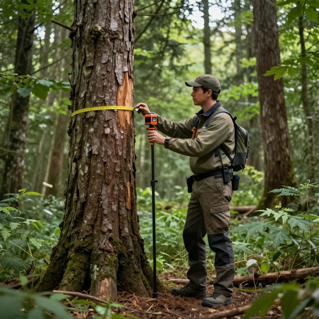
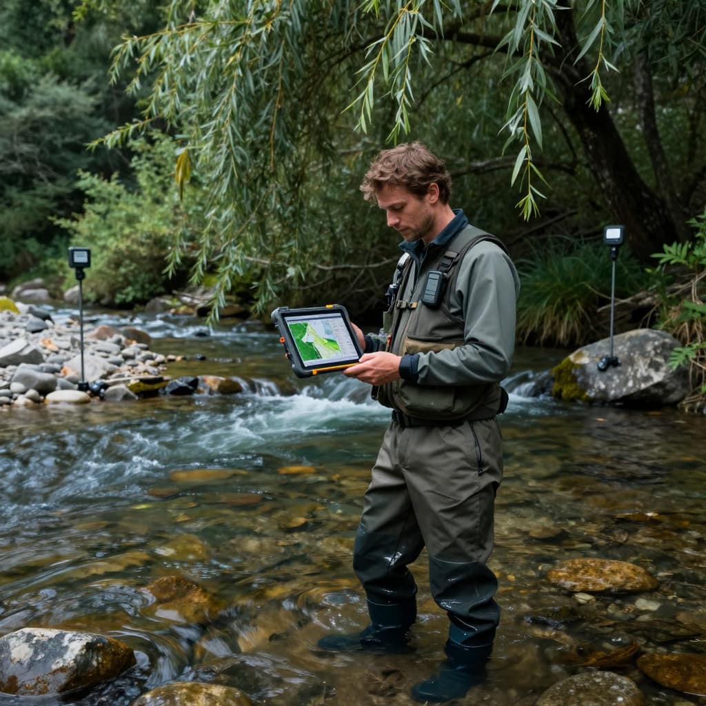
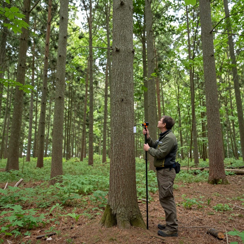 Traditional forest inventory relies on circular sample plots with manually measured tree positions relative to a plot centre — a method that is slow, labour-intensive and difficult to reproduce exactly. RTK enables a fundamentally different approach: every tree in a stand can be individually geolocated with a handheld receiver in seconds, creating a spatial database where each stem has an exact coordinate, not just a plot-relative offset.
This georeferenced inventory integrates directly with LiDAR-derived canopy height models, species classification maps from satellite imagery, and historical growth records. The combination allows forest managers to generate accurate per-hectare volume estimates, plan selective thinning operations at the individual tree level, and monitor the same trees across inventory cycles with absolute precision.
One operator can record 200–400 trees per day including species, DBH, and health status, with stem position accuracy of 2–5 cm using a multi-constellation receiver. The resulting data is compatible with all standard forestry GIS platforms: QGIS, ArcGIS, Forester’s Assistant, and Trimble Forestry.
Research reference: MDPI Forests — GNSS performance under forest canopy: a systematic review
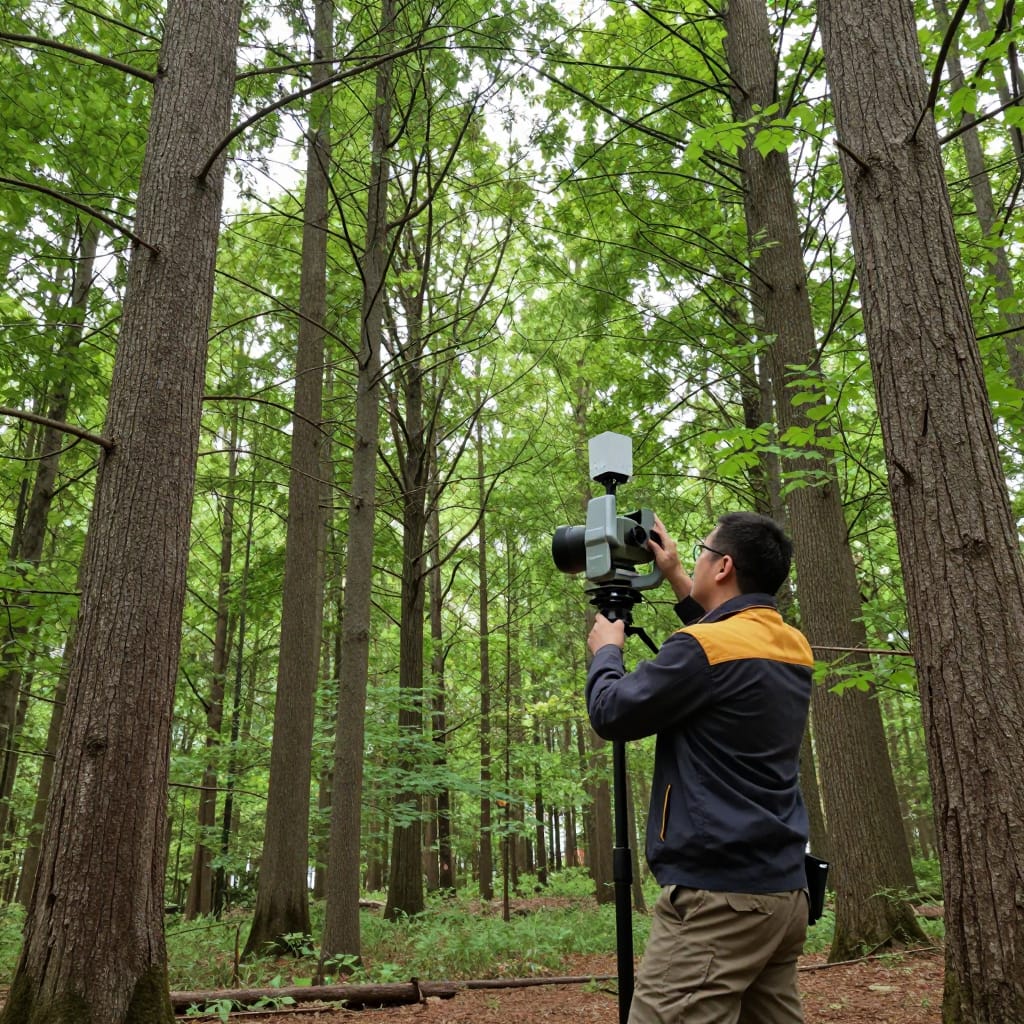 LiDAR (Light Detection and Ranging) combined with RTK GNSS is the most powerful tool currently available for characterising forest structure. The laser sensor fires millions of pulses per second; by measuring the precise return time of each pulse, it builds a dense 3D point cloud that captures everything from the top of the canopy to the forest floor — including trees, undergrowth, terrain topography, and even individual branches.
What makes LiDAR uniquely valuable in forestry is its ability to penetrate canopy gaps and resolve the true ground surface beneath dense vegetation — something optical imagery cannot do. When RTK geolocation is applied to every scan position (whether from a UAV or a terrestrial scanner), the resulting point cloud is georeferenced to centimetre accuracy. From that point cloud, foresters can extract tree height and crown width for every detectable stem, canopy height models (CHM) and digital terrain models (DTM) simultaneously, stand volume and biomass estimates calculated directly from structural metrics without destructive sampling, gap fraction and light transmission indices for regeneration planning, and terrain models for road planning, drainage analysis and slope stability assessment.
Research reference: Remote Sensing of Environment — Airborne LiDAR for forest inventory: a review of methods
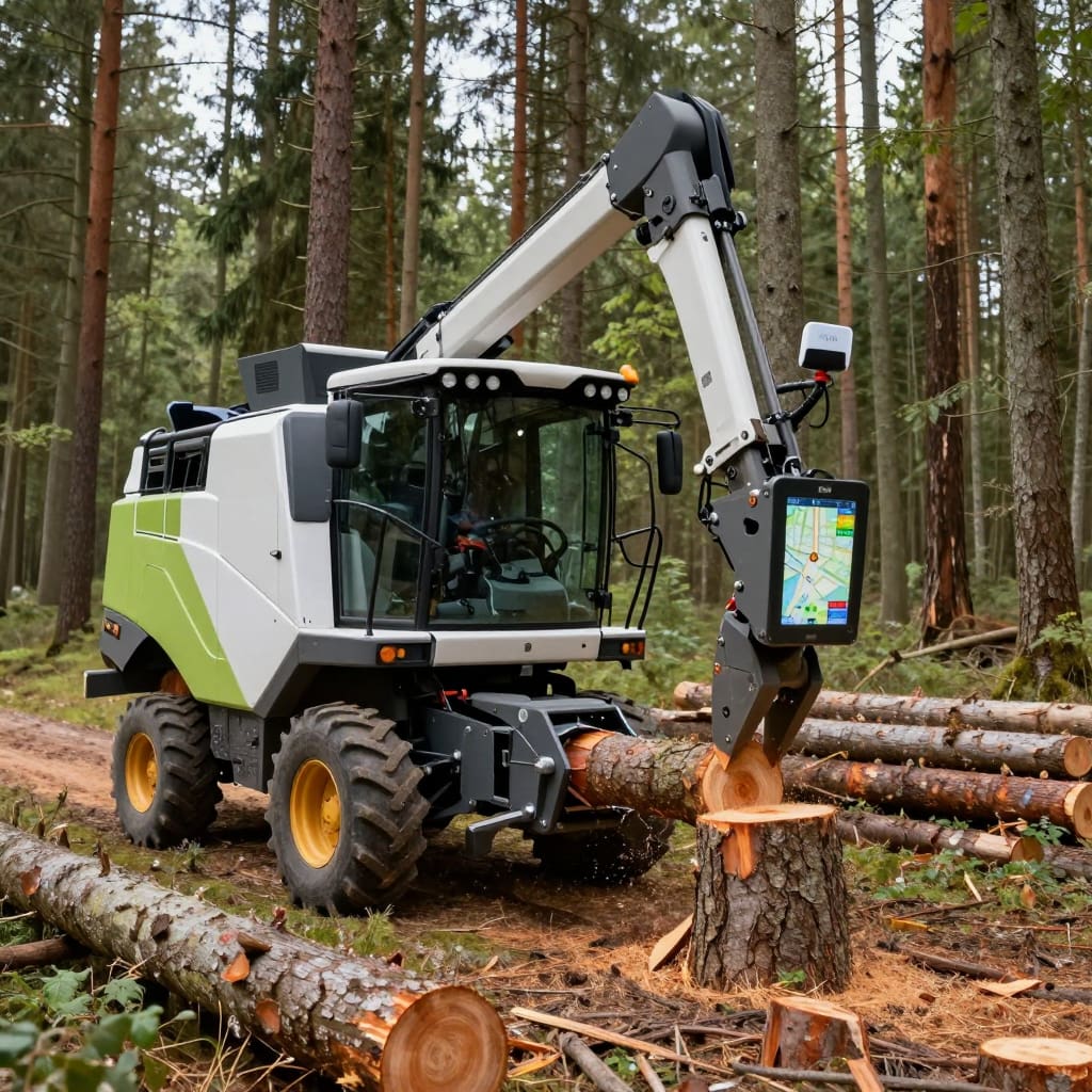 A modern cut-to-length harvester is already a sophisticated machine — but without accurate positioning, it has no way to record where each stem was felled or to follow a pre-planned harvesting pattern with precision. Integrating an RTK receiver directly into the machine’s cabin or on the crane boom gives operators a live, centimetre-accurate position on a digital forest map, and allows the harvester’s computer to automatically log the GPS coordinate of every tree it processes.
The operational benefits compound quickly. When each felled tree is individually georeferenced, the resulting harvest map can be compared directly against the pre-harvest inventory to verify that the correct stems were removed, that leave-trees were undisturbed, and that harvest is proceeding within the legally permitted zone. This level of traceability is increasingly required by FSC and PEFC certification bodies and by timber buyers in regulated markets.
RTK also enables pre-planned strip roads and headings to be driven with sub-decimetre accuracy, reducing unnecessary soil disturbance and minimising damage to residual trees — a significant benefit in selective cutting and shelterwood systems. Integration is via NMEA over RS232, USB or CAN bus, compatible with John Deere TimberNavi, Ponsse Opti and custom OEM platforms.
Research reference: Agricultural and Forest Meteorology — GNSS-based machine guidance for precision silviculture
 Forest carbon credits — whether traded on voluntary markets or under compliance schemes — require rigorous, auditable measurement of the carbon stored in standing timber. The accuracy of those extrapolations depends critically on how well the sample plots represent the spatial variability of the forest.
RTK GNSS enables high-quality carbon measurement in three concrete ways. First, it allows permanent sample plots to be established with exact coordinates so they can be re-measured in future inventory cycles on the exact same footprint — eliminating the boundary uncertainty that inflates measurement error. Second, it allows inventory teams to collect spatially dense data sets that capture fine-scale variability in basal area and stocking. Third, it provides the ground control needed to validate and calibrate biomass estimates derived from UAV photogrammetry or satellite-based allometric models.
Verra (Verified Carbon Standard), Gold Standard and other major voluntary carbon market registries accept GPS-referenced ground measurements provided they meet stated accuracy standards. RTK-derived survey data — with documented accuracy metadata — exceeds the thresholds specified by these registries by a wide margin.
Research reference: International Journal of Remote Sensing — GNSS-based ground truth for forest carbon monitoring
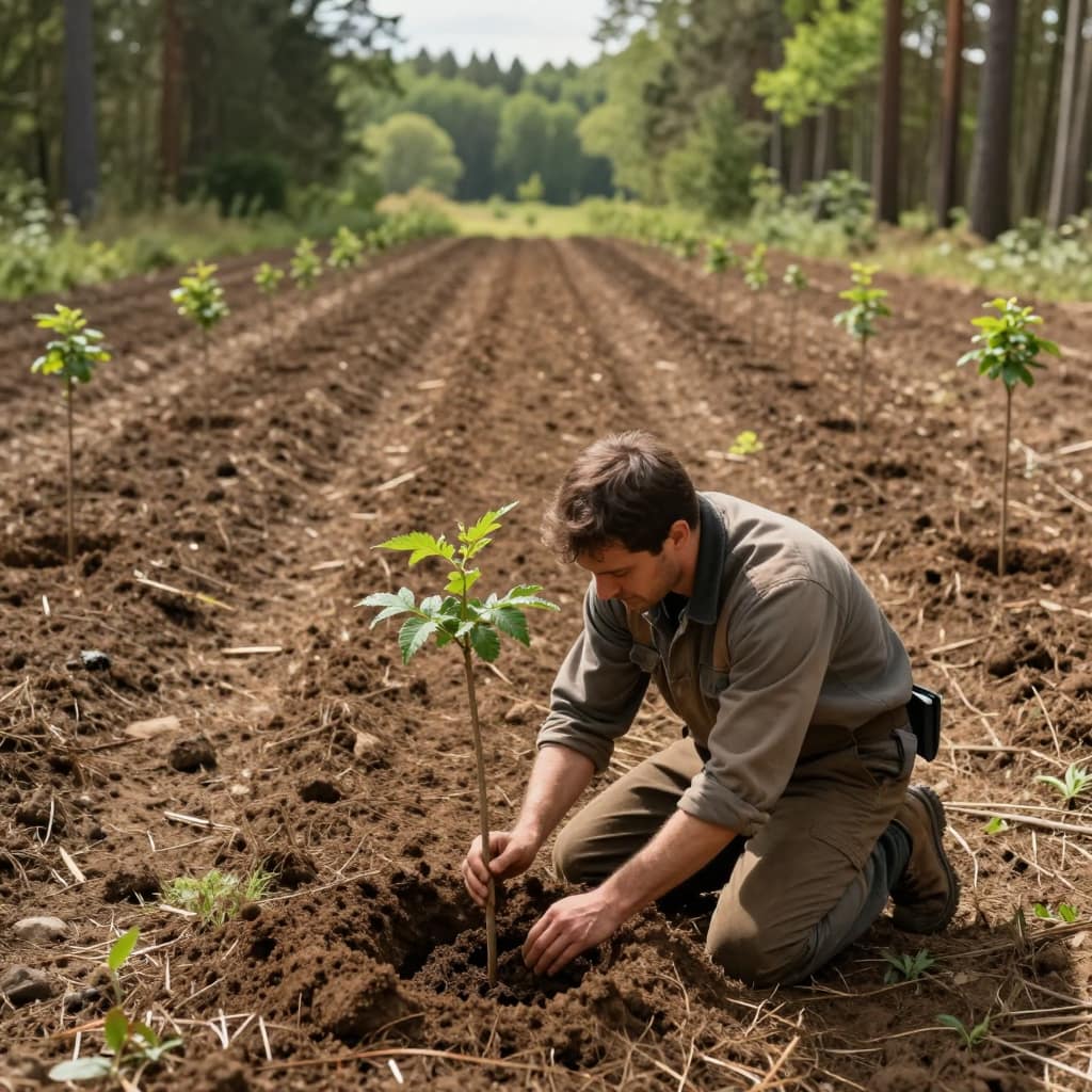 Reforestation projects present a deceptively simple positioning challenge: plant the right species in the right places and prove it to a funder or regulator. RTK handhelds solve this cleanly. Each planting crew member carries a receiver connected to a mobile GIS app that shows their real-time position against the planting plan. The app guides them to the next planned planting point, logs a GPS fix when the seedling is placed, and records the species, stock type and health status as attributes on that point.
At the end of the day, project managers have a complete, auditable planting record with coordinates accurate to a few centimetres. Planting density can be automatically verified against contract specifications without office processing. Data captured in QField or ESRI Collector synchronises to a central GIS project in real time over mobile data.
For large-scale reforestation contracts — common in government-funded land restoration programmes — this data becomes the evidentiary basis for milestone payments. The ability to produce a georeferenced planting map with accuracy metadata demonstrably superior to smartphone GPS is a competitive differentiator in tender submissions.
Research reference: Remote Sensing — Satellite and GNSS-assisted monitoring of large-scale reforestation
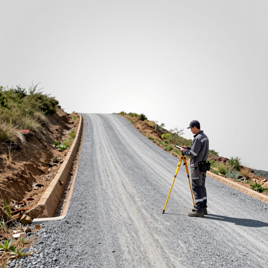 Forest roads account for a disproportionate share of the environmental impact of timber operations. A poorly planned road alignment crosses unnecessary watercourses, traverses unstable slopes, and requires excessive cut-and-fill — all of which translate to erosion, sedimentation, and costly maintenance. Getting road design right requires accurate terrain data, and that means RTK.
The workflow typically combines UAV-LiDAR for the initial terrain model with RTK stake-out for construction. The LiDAR survey provides a 5–10 cm resolution DTM that engineers use to optimise alignment, calculate earthwork volumes, and identify drainage crossing points. During construction, RTK rovers guide operators to exactly where slope stakes, drainage culverts and road centreline points need to be placed, with centimetre accuracy that prevents costly deviations from the design.
After construction, periodic RTK surveys monitor pavement rutting, drainage blockages and slope movement — providing the objective spatial data needed to prioritise maintenance spending. The same data can be shared with equipment operators to keep heavy machinery on approved routes and off sensitive ground.
Research reference: USDA Forest Service — Low-volume road engineering best practices (PDF)
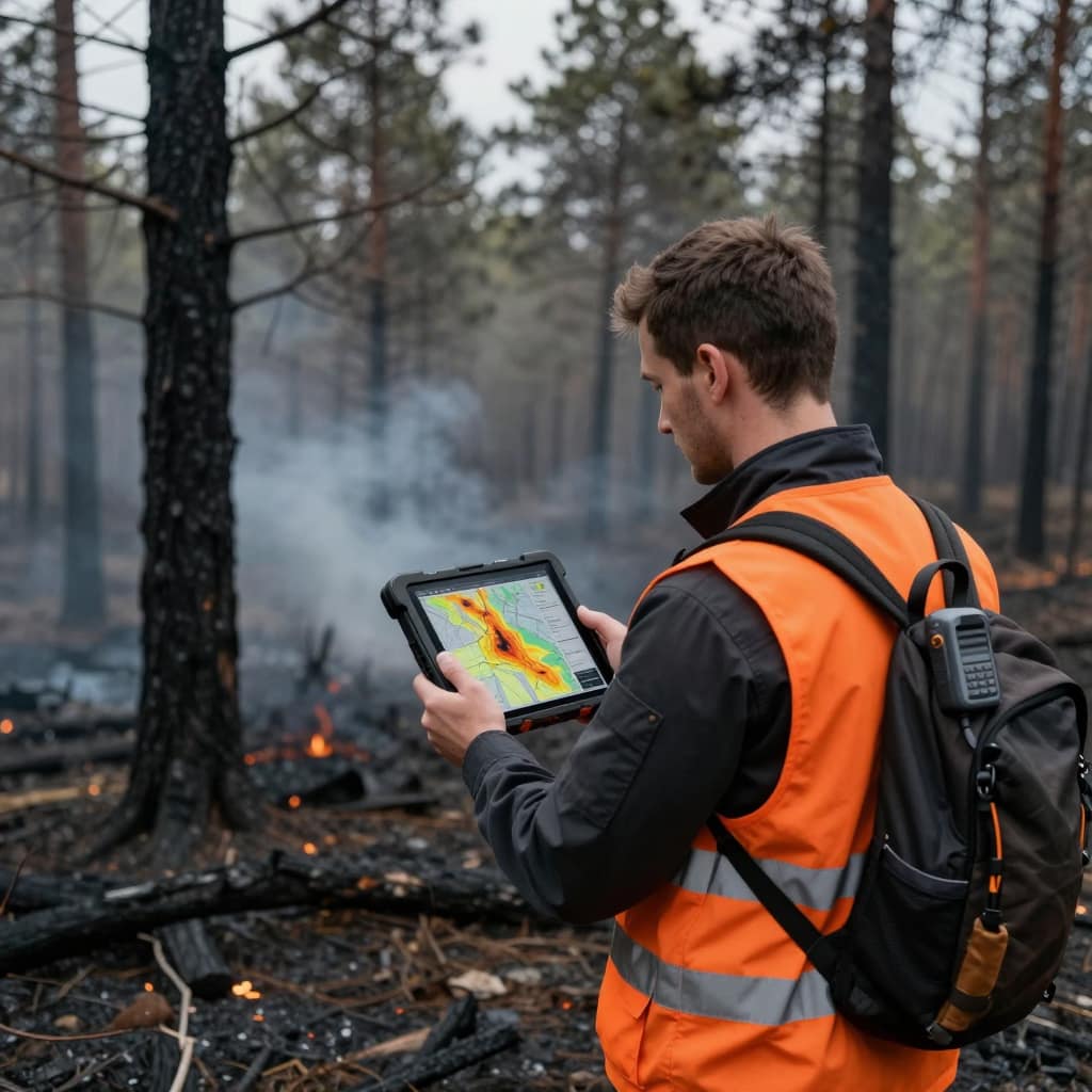 Wildfire risk in managed forests is a function of fuel load, terrain, road access, and the location of high-value assets relative to ignition sources. All of these factors are spatial — and all require accurate positioning to be useful in operational fire planning.
At the strategic level, precision inventory data from RTK surveys feeds directly into fuel load models and fire behaviour simulators. Knowing the exact standing volume and spatial arrangement of fuel — live and dead — allows fire modellers to predict fire intensity and spread with much greater confidence than is possible from generalised stand-type data.
At the operational level, RTK-equipped UAVs flown during or after a fire provide thermal imagery and 3D damage assessments georeferenced to centimetre accuracy. This allows fire managers to see exactly where the fire boundary lies, assess the completeness of prescribed burns, and plan salvage operations with precision. Post-fire RTK surveys of soil and terrain changes are also critical inputs for erosion and flood risk models used in recovery planning.
Research reference: Remote Sensing — UAV-based post-fire mapping and damage assessment in forest ecosystems
 Forest hydrology — how water moves through a catchment, how quickly streams respond to rainfall, how effectively the forest buffers downstream flood peaks — is increasingly central to both forest management certification and regulatory compliance. Understanding it requires accurate spatial data on stream networks, channel morphology, buffer zone extent, and the location of drainage structures.
RTK GNSS enables hydrological surveys that would be impractically slow with total station equipment. Surveyors can walk stream centrelines measuring channel cross-sections at regular intervals in a fraction of the time previously required. Riparian buffer zone boundaries — which must be mapped and respected under most modern forest management standards — can be established from the stream centreline using RTK-referenced offsets that are defensible in regulatory audits.
Repeated RTK cross-section surveys of stream channels provide objective monitoring data for channel stability, erosion, and the effectiveness of buffer zones in filtering sediment from harvesting operations — critical data for demonstrating compliance with water-quality conditions on harvest licences.
Research reference: US EPA — Riparian areas: functions, values, and appropriate level of use
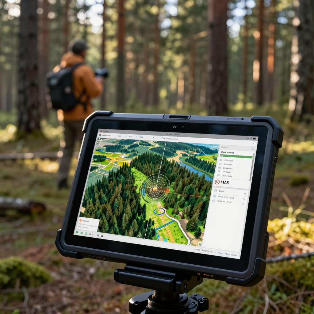 Modern forest management is increasingly driven by spatial data — stand-level inventories, harvest planning maps, road networks, protected area layers, wildlife corridors, soil sensitivity maps — all maintained in a Forest Management Information System (FMIS). The quality of every layer in that system ultimately depends on the accuracy of the field data that feeds it.
RTK GNSS is the field data collection tool that justifies the investment in a sophisticated FMIS. When inventory plots, boundary surveys, road centrelines and infrastructure locations are all collected with 1–2 cm accuracy, the entire management system becomes more reliable — and the value of cross-referencing between layers becomes much greater.
RTK kits integrate seamlessly with professional GIS field applications. Platforms like QField, Mapit GIS, ESRI Field Maps, Apglos Survey Wizard and Aplitop can all accept NMEA input from an RTK receiver over Bluetooth, overlaying centimetre-accurate position on any vector or raster layer. Surveyors capture attribute data alongside each spatial point — tree species, DBH, crown condition, obstacle type — producing a fully attributed GIS layer ready for desktop analysis.
Research reference: QField — open-source mobile GIS for field data collection with external GNSS
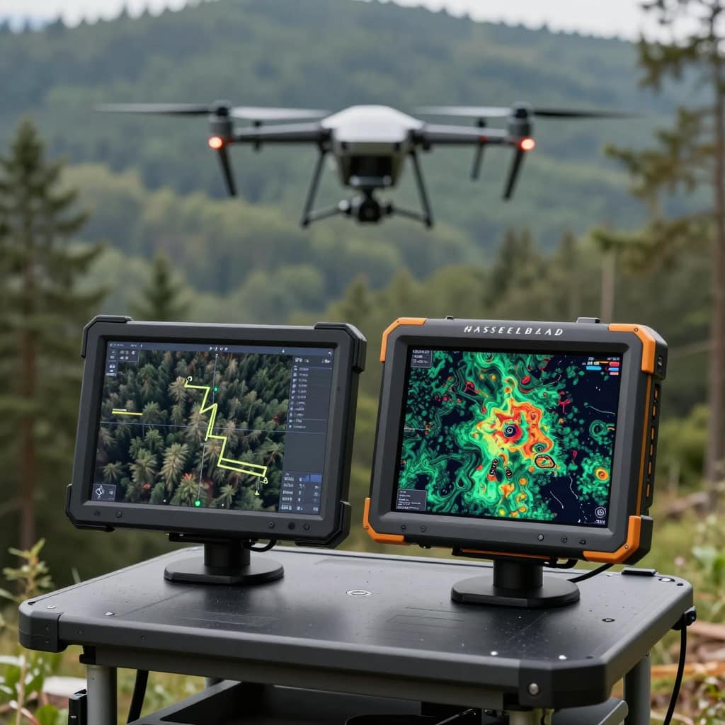 Drone-based photogrammetry has become one of the most cost-effective tools for large-scale forest monitoring. A UAV equipped with a calibrated camera and an RTK or PPK receiver captures thousands of overlapping images; photogrammetry software (Pix4D, Agisoft Metashape, OpenDroneMap) stitches them into a georeferenced orthomosaic, dense point cloud and digital surface model.
Without accurate positioning, a UAV photogrammetry survey requires 5–10 precisely surveyed ground control points (GCPs) placed across the survey area before flying — a time-consuming process in a forested landscape. With an RTK receiver on the UAV, each image is stamped with a centimetre-accurate position at the time of capture. This PPK approach removes the GCP requirement on flat to moderately sloping terrain.
The outputs include canopy height models at 5–10 cm per pixel resolution — sufficient to detect individual crowns and estimate tree heights to ±0.5 m — as well as change detection between multi-temporal surveys that identifies storm damage, disease outbreaks and illegal clearing, and volume calculations for log decks, slash piles and earthworks directly from point cloud data.
Research reference: Geocarto International — Accuracy assessment of RTK/PPK UAV photogrammetry projects
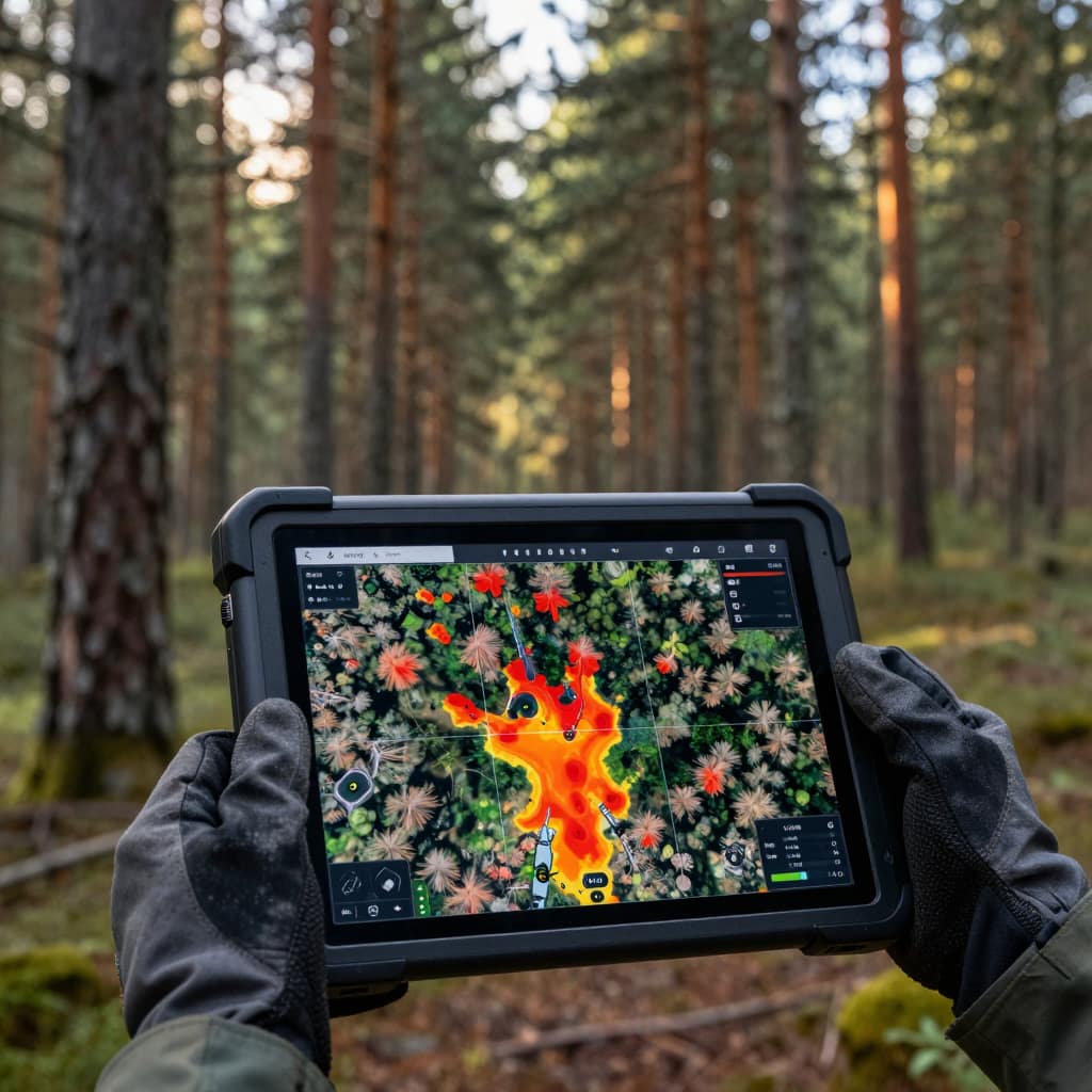 Bark beetle outbreaks, root rot infections, windthrow events and drought stress affect individual trees before they cause stand-level mortality — but only if they are detected early enough to permit an effective response. Detecting and precisely locating these early symptoms requires combining spectral data from satellite or UAV imagery with accurate ground truth from field surveys.
When a forest health inspector identifies an infected or damaged tree in the field, an RTK receiver gives the exact position of that stem — which can then be matched to its pixel in a multispectral UAV image, verified against the inventory record, and compared to spectral anomaly maps produced by image analysis software. This ground-truth loop is what allows remote sensing models to be calibrated and validated so they can be applied at scale.
For active outbreak monitoring — tracking the spread front of a bark beetle infestation, for example — RTK survey teams walk systematic transects through affected areas, flagging infested trees with precise coordinates and recording infestation severity. The resulting spatial database supports accurate delineation of treatment zones for salvage harvesting, making the response proportionate and auditable.
Research reference: MDPI Forests — UAV-based detection of bark beetle infestations: ground truthing requirements


