Breaking the Canopy Barrier: How BOKU’s Human-Centered AI is Revolutionizing RTK Precision in Forestry
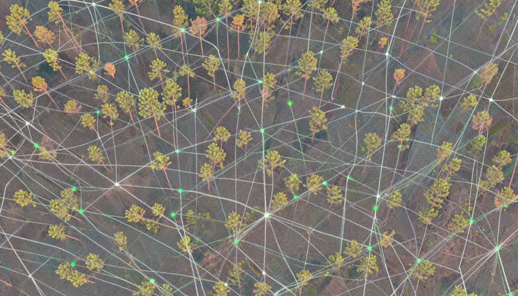
Precision is the heartbeat of modern geomatics, but for decades, that heart has skipped a beat whenever a surveyor stepped under the “green shield” of a forest canopy. While Real-Time Kinematic (RTK) positioning has mastered the open field, the dense, multi-layered environments of forest stands have remained a final frontier of sorts—riddled with signal drops, […]
Forestry
GNSS/RTK solutions for Forestry Map forest borders like a professional surveyor Do you want to check and mark forest borders or hunting areas? Use ArduSimple professional kits to measure the border of forest or compare cadastral data. With ArduSimple kits, you can establish the property corners and property lines of a parcel of land with […]