Surveying and mapping have always shared the same core requirement: positional data you can trust. Not “approximately right,” and certainly not just “good enough for navigation.” We are talking about centimeter-level accuracy, delivered consistently under challenging field conditions.
For over 15 years, RTK GNSS has been the industry standard for this level of precision. The underlying principle remains constant: a rover receiver corrected in real-time against a known reference, resolving carrier-phase ambiguities to achieve results that once required hours of static post-processing. Surveyors adopted it because it worked—and because the alternative, total station traverses across vast areas, simply didn’t scale.
A decade ago, a survey-grade RTK setup represented a massive capital investment. It was a tool reserved for established firms with significant pipelines, remaining effectively out of reach for smaller operations, independent researchers, or teams with tight project budgets. The technology was there, but the cost was the barrier.
The shift came from an unexpected direction: mass-market silicon. As GNSS became embedded in global consumer electronics, chip manufacturers invested billions into miniaturizing and optimizing processing. Crucially, accuracy didn’t degrade—it improved.
The result is a complete change in the cost structure of high-precision hardware. Today, equipment that would have cost tens of thousands of euros a decade ago is available at a fraction of that price—with the same survey-grade integrity.
This is not a compromise. Centimeter-level RTK positioning is absolute, whether the receiver costs €500 or €50,000. The physics of carrier-phase measurement remains the same. What has changed is the silicon, the manufacturing scale, and the global supply chain—not the output.
For the surveying industry, this isn’t just a minor update. It is a structural shift in access, ensuring that professional-grade spatial data is available to those who need it, regardless of the size of their firm.
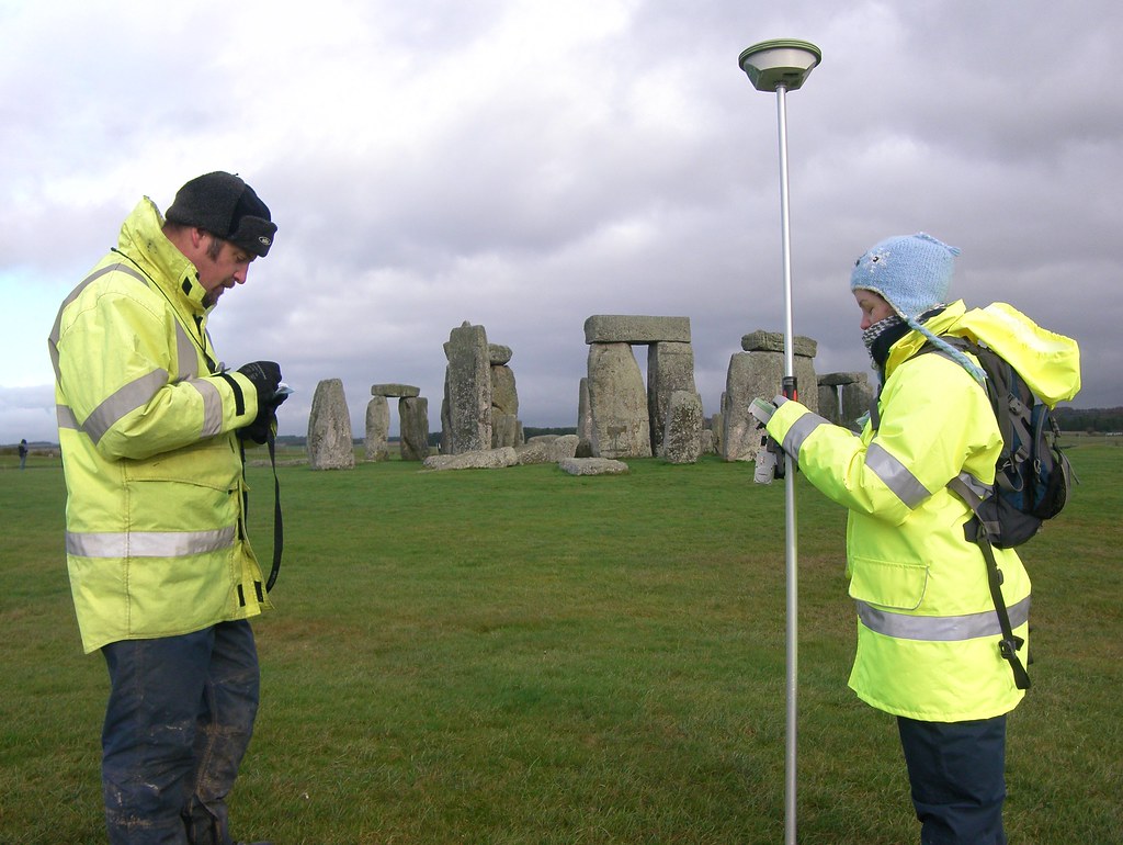
Most land-related disputes—boundary conflicts, encroachments, or subdivision disagreements—don’t start with bad intentions. They start with imprecise data that nobody questioned until it truly mattered.
A fence installed “approximately right,” or a plot divided based on cadastral references that haven’t been field-verified in decades, creates a liability. The moment precision matters is usually the moment someone realizes they never had it. Centimeter-level GNSS positioning eliminates this ambiguity, providing a definitive spatial record for every stakeholder.
High-precision RTK technology covers the full operational range of land management, from routine checks to technically demanding legal documentation:
Cadastral Accuracy: Calculate plot coordinates with a level of precision that aligns with official records. No more “close enough for the sketch”—this is data that holds up in a notary’s office or a legal briefing.
Topographic Integrity: Build plans and maps on a reliable spatial framework, whether managing a flat urban parcel or complex terrain with irregular boundaries.
Direct Staking: Establish markers and reference points directly from design coordinates. The boundary goes exactly where the document says it is, not where someone estimated it to be.
Real-Time Visualization: Overlay complex geometry onto platforms like Google Earth in real time. This is essential for communicating spatial data to clients, contractors, or authorities who don’t work with raw coordinate files.
Sometimes the requirement is simpler: you just need to verify if a neighbor’s new fence is on the right side of the line. In those moments, you need an answer you can stand behind with absolute confidence.
Whether it’s a complex subdivision or a quick boundary check, you need the same professional-grade tool. The only difference is the length of the field session.
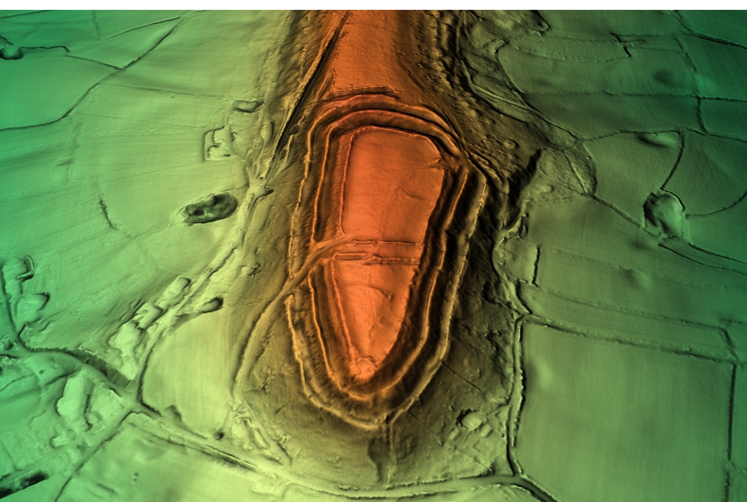
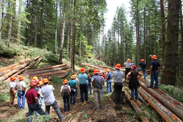
Archaeological fieldwork operates under a tension every researcher understands: the need to move fast enough to cover ground, yet slow enough to ensure no feature is missed. Above all, every point documented must be spatially coherent across the entire site.
Building a reliable spatial framework is more complex than it appears on paper. A landscape survey isn’t just about flagging interesting spots; it’s about creating a coordinate system that allows teams to work in parallel—across different trenches, zones, and seasons—and still produce data that aligns perfectly during post-excavation analysis.
High-precision RTK GNSS positioning is a force multiplier at every stage of the mission:
Landscape Planning: Divide survey areas into systematic corridors with absolute coordinate boundaries. When coordinating teams across a hillside, “roughly here” creates gaps that compromise survey integrity. RTK ensures 100% coverage.
Feature Documentation: Every find, soil anomaly, or architectural feature receives a position that is survey-accurate, not just “GPS-accurate.” This allows for seamless cross-referencing and precise re-visitation years later.
Aerial Integration: RTK provides the necessary Ground Control Points (GCPs) for drone-based photogrammetry and orthomosaics—now a standard on professional excavations—without the logistical overhead of a traditional survey crew.
In archaeology, portability is a functional requirement, not a luxury. Most sites aren’t next to a paved road. You need equipment that fits into a daypack, runs on standard power, and survives the elements.
An RTK kit that fits in your hand while maintaining centimeter-level precision stops feeling like “surveying equipment” and starts feeling like an essential part of the excavation kit. It allows the archaeologist to focus on the stratigraphy and the artifacts, knowing the spatial record is absolute.
Surveying engineers don’t usually end up on jobsites by accident. The work finds you—and once you’re in it, you realize quickly that every other trade in construction depends on what you do first.
Staking out markers and control points isn’t just a “preliminary step” before the real work starts. It is the real work. A single misplaced reference point doesn’t just stay on paper; it propagates through foundation pours, structural steel, and MEP rough-ins. Sometimes, an error of 15 centimeters on day one isn’t caught until the final inspection, leading to catastrophic rework costs.
Whether you are establishing the alignment of a highway interchange, setting control for a bridge abutment, or staking the footprint of a high-rise, the scope varies but the requirement remains absolute: the position must be right, and it must be legally defensible.
The contractors on the other end of your marks aren’t checking your work. They are trusting it.
RTK GNSS technology fits into this workflow not to replace the judgment of a surveying engineer, but to remove the tasks that don’t require judgment. It automates the repetitive occupation of points, manual coordinate lookups, and the tedious back-and-forth between field notes and design files.
What’s left is the work that actually needs a trained eye:
Understanding Design Intent: Translating complex engineering plans into actionable site reality.
Conflict Anticipation: Identifying spatial issues before the first shovel hits the ground.
Ground Truth Validation: Knowing instinctively when a number that looks perfect on a screen won’t work in the physical world.
That expertise is the part no kit ships with. But the right tools ensure that it is the only part you are spending your valuable time on.
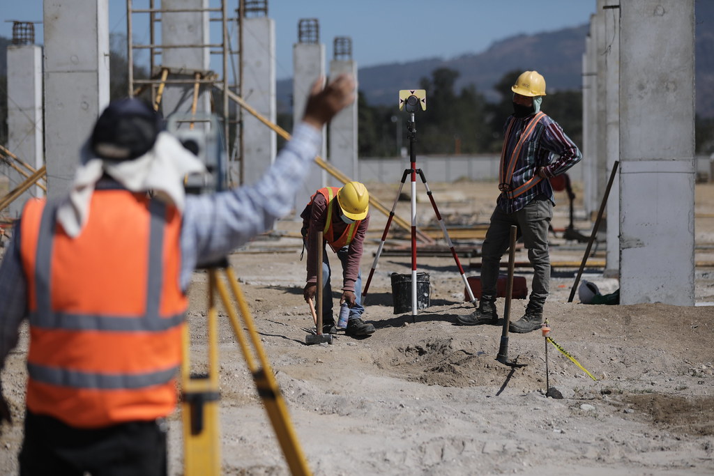
Construction staking is the exact moment where a project stops being a PDF and starts being real. It is the critical process of translating blueprints into physical markers on the ground—establishing precisely where foundations are poured, where utilities run, and where grade changes occur.
Done well, it keeps every trade synchronized under the same spatial reference. Done poorly—or skipped—and you are looking at rework that no contingency budget was ever designed to absorb.
The traditional approach—total stations, prism poles, and two-person crews—is a proven method, but it is inherently slow. It accumulates significant overhead across every staking session of the project lifecycle. RTK GNSS kits change this dynamic fundamentally.
With a properly configured RTK setup, a single operator can stake points with centimeter accuracy, working directly from the design files loaded into a field controller. By removing manual angle calculations and line-of-sight constraints, the blueprint effectively becomes the instrument.
In practice, this operational efficiency means:
Proactive Error Detection: Deviations from the plan are caught during the layout phase, not weeks later during a failed inspection.
Compressed Layout Cycles: Staking sessions that traditionally took half a day are now completed before lunch, keeping the heavy machinery moving.
Integrated As-Built Documentation: The same kit used for staking can instantly document as-built positions as the job evolves, providing a continuous audit trail without extra overhead.
Client Transparency: Significantly less time spent explaining to stakeholders or clients why a structural element needs to be moved.
If your projects involve repetitive staking across multiple phases—grading, foundations, MEP rough-in, or final layout—the time savings compound. It is a logic that shows up clearly on the job cost report by the end of the month.
That is the part the spec sheet won’t tell you, but the site foreman always figures out by the second week on the job.
Managing large-scale stockpiles—whether in cement plants, quarries, or aggregate yards—is one of those “invisible” challenges that quietly drains the budget when things go wrong. Traditional estimation works until it doesn’t, and in industrial operations, that failure usually happens at the worst possible moment.
Digital Elevation Modeling (DEM) has fundamentally changed the equation. What once required a dedicated survey crew and days of post-processing is now a routine site task. This shift is operational: volume audits that used to be quarterly events can now happen whenever you need them, providing centimeter-level accuracy that you can confidently defend in front of a client or an auditor.
One detail that often gets overlooked is orthometric height—elevation referenced to mean sea level, rather than a “floating” local datum. In professional workflows, this distinction is critical. If you are comparing stockpile volumes across multiple sites or feeding data into logistics software, you need consistent, absolute elevation data, not a workaround.
This is where the integration of RTK technology with standard Android devices proves its value in the field. By removing the need for expensive legacy hardware, a site manager can walk a stockpile, capture survey-grade elevations, and have actionable data ready before the morning meeting is over.
Ultimately, it’s not about collecting more data—it’s about having the right data in your pocket exactly when a decision needs to be made, not forty-eight hours later when the external report finally arrives.
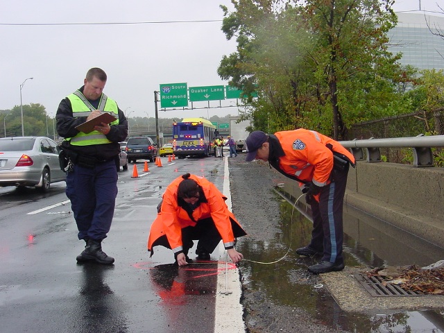
RTK GNSS-based forensic mapping has become one of those mission-critical tools that, once deployed in a high-pressure environment, quickly proves indispensable. Whether managing a multi-vehicle highway crash, a complex fire investigation, or a high-stakes criminal scene, traditional manual measurements and hand-sketched diagrams are often too slow, and human error or parallax distortion can have real consequences on the investigation.
From field experience, collision reconstruction units that previously required four to six hours for manual scene documentation now often complete the process in under 45 minutes. Of course, real-world conditions aren’t always perfect: sometimes debris is partially buried under mud, vehicles are oddly positioned, or weather hampers line-of-sight measurements. That’s when the surveyor’s judgment matters—knowing when to pause, double-check, or re-scan certain areas to ensure nothing is missed.
This speed comes paired with centimeter-level XYZ accuracy (Global and Local coordinate systems), allowing digital twins and 3D models to remain legally defensible and robust under cross-examination in court. Yet, the real value isn’t just in numbers—it’s in how operators interpret the data, spot anomalies, and decide the best way to document tricky scenes.
For professionals generating Point Clouds, analyzing explosion paths, or mapping debris fields, a dedicated RTK system fundamentally changes operational capabilities. It’s not about flashy hardware; it’s about maintaining data integrity, streamlining the chain of custody, and reducing technical overhead so investigators can focus on critical decisions, not repetitive measurements. And yes, sometimes that means improvising in the field—shifting a scanner, dealing with uneven terrain, or working around emergency responders—because real investigations rarely go exactly as planned.
In short, RTK GNSS mapping doesn’t just make the job faster. It ensures crews avoid missing critical evidence, preserves the legal defensibility of findings, and gives investigators the confidence to focus on what matters most: understanding the scene and making informed, defensible decisions—even under unpredictable conditions.
Geotagging is one of those features that sounds straightforward—until you’re back from the field facing a dataset of several thousand images. That’s when you realize it’s not just a technical spec; it’s the difference between a streamlined workflow and a manual nightmare.
At its core, geotagging appends precise geographic coordinates to your media—photos, videos, or even QR records. But in a professional environment, the real value happens after the data collection. When every image carries accurate position and timestamp metadata, tasks like photo-merging and orthomosaic generation transition from a manual headache to a seamless, automated process.
For aerial mapping missions, this is a game-changer. Instead of the tedious post-mission task of correlating flight logs with image files, your workflow becomes significantly cleaner. By defining capture points directly in your mission planner, every frame lands exactly where it belongs: tagged, synchronized, and ready for processing.
In PPK and RTK-enabled setups, this precision is non-negotiable. The accuracy embedded in each image metadata directly determines the integrity of your final deliverables—be it a high-density Point Cloud, a Digital Elevation Model (DEM), or a survey-grade orthophoto.
Choosing the right integration Navigating the gap between entry-level tagging and a centimeter-accurate RTK pipeline can be complex. The right choice depends more on your specific operational constraints than on a spec sheet.
If you’re unsure which setup fits your current workflow, reach out to us. We’ll skip the sales pitch and help you find the technical fit that actually works for your field conditions. We typically get back to you within 24 hours.

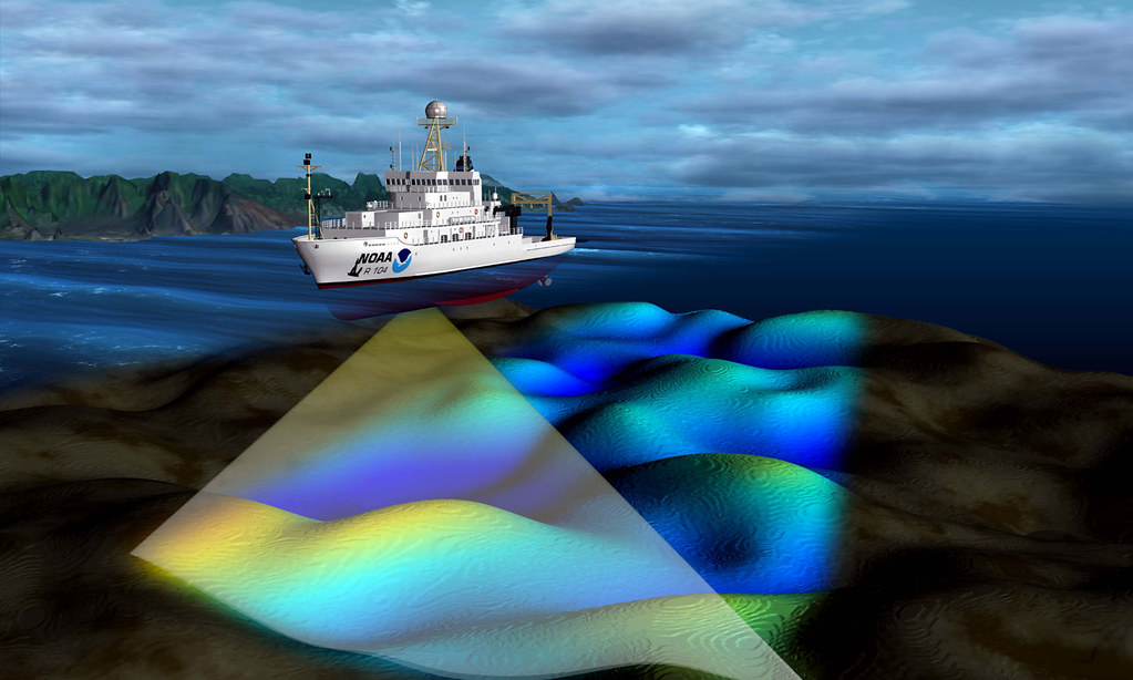
Hydrographic Surveying involves mapping underwater terrain and collecting essential data about rivers, lakes, and seabeds. Its main uses include:
In offshore and deep-water operations, this work becomes even more critical. Vessels used for deep-water drilling are incredibly expensive assets — often costing tens or hundreds of thousands of dollars per day to operate. Any downtime caused by positioning errors or inaccurate data can result in massive financial losses.
That’s why sustained, high-accuracy positioning is not just important — it’s essential. Whether it’s keeping a drillship exactly on station, guiding a pipelay vessel, or ensuring a survey boat follows precise survey lines, reliable positioning helps avoid costly interruptions and keeps operations running safely and efficiently.
From pre-construction seabed mapping to real-time positioning during installation, hydrographic surveying combined with precise GNSS and motion compensation systems provides the foundation for successful marine projects.
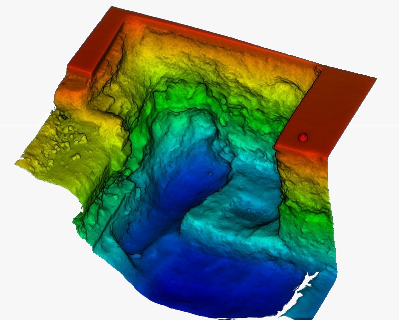
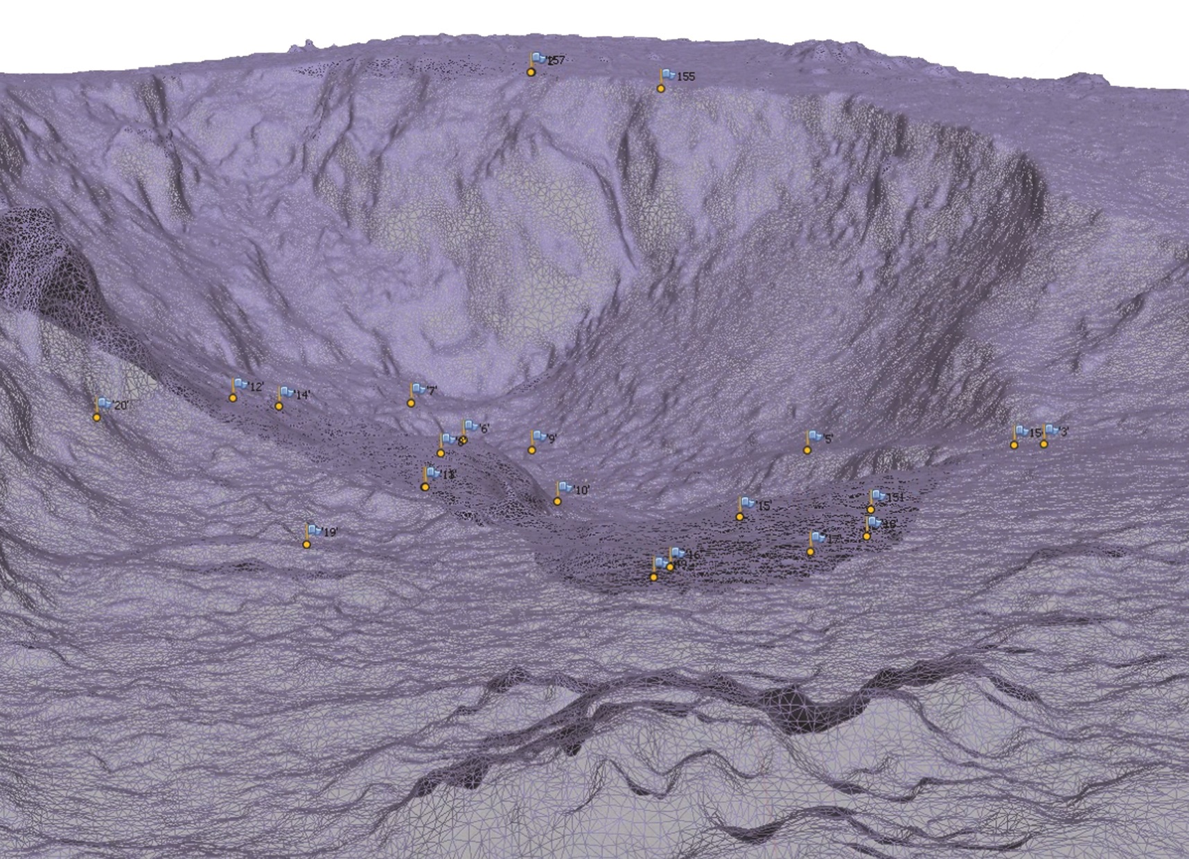
LiDAR is one of those technologies that looks straightforward until you are the one responsible for the final data quality. That is when you realize that a LiDAR system is only as strong as its weakest component.
At its core, the system measures the flight time of laser pulses. However, transforming those pulses into a survey-grade digital twin requires the tight coordination of three critical subsystems: the laser ranging unit, a high-accuracy RTK GNSS receiver, and an Inertial Measurement Unit (IMU). If any of these underperforms, the error doesn’t stay isolated—it propagates through the entire point cloud, shifting your data out of reality.
A raw point cloud is just a dense, unclassified mass of data. The real value is unlocked during Classification:
Terrain Extraction: Separating ground returns from vegetation and noise is the foundation of any meaningful Digital Terrain Model (DTM).
Feature Identification: Serious workflows go further, distinguishing tree canopies from infrastructure like power lines—details that often vanish in standard remote sensing.
Surface Analysis: Once classified, ground points are interpolated into continuous surfaces for volumetric analysis, flood modeling, or change detection.
The GNSS component is never a peripheral detail. In airborne or mobile LiDAR, the position and timing accuracy of the RTK receiver directly determines the absolute accuracy of every single point in your dataset.
A centimeter-level offset at the sensor level doesn’t just “average out”—it misaligns the entire cloud. This is why antenna placement, baseline distances, and correction reliability are just as critical in LiDAR setups as they are in traditional land surveying.
Whether you are monitoring coastal erosion, mapping utility corridors, or building atmospheric datasets, the positioning backbone is where accuracy is either built-in or lost.
If your LiDAR application demands survey-grade GNSS performance, that is exactly the problem we solve. We provide the positioning foundation so you can focus on the analysis.
High-Precision Geospatial Solutions
High-accuracy GNSS isn’t just about specs on paper. In the real world, it’s about whether the system still works on cold mornings, in unstable terrain, with poor connectivity, and when the project schedule won’t wait for perfect conditions.
We’ve seen it used in very different situations — from infrastructure monitoring to environmental mapping — but the real need is always the same: measurements that stay reliable over time, even when everything around them changes.
Structural & Geotechnical Monitoring Engineers are moving away from occasional manual surveys and toward continuous monitoring. With centimeter-level accuracy in real time, you can detect small movements in buildings, slopes, or earthworks long before they turn into visible or structural problems.
Environmental & Forestry Work Out in the forest or in remote areas, field teams care more about getting the job done efficiently than about fancy features. Good positioning makes trail mapping, habitat monitoring, boundary definition, and long-term observation much simpler — and saves you from spending hours fixing data afterwards.
Custom GIS and Hardware Development Standard surveying gear doesn’t always fit custom or experimental projects. When you’re building compact receivers, pole-mounted systems, or specialized mapping devices, you need flexible GNSS modules that adapt to your design instead of forcing you to redesign everything around the equipment.
Some teams take a complete kit and put it straight into production. Others test, fail, iterate, and end up building something completely unique. Both approaches are valid. The important thing is that the positioning technology fits naturally into the workflow instead of becoming another thing you have to manage.
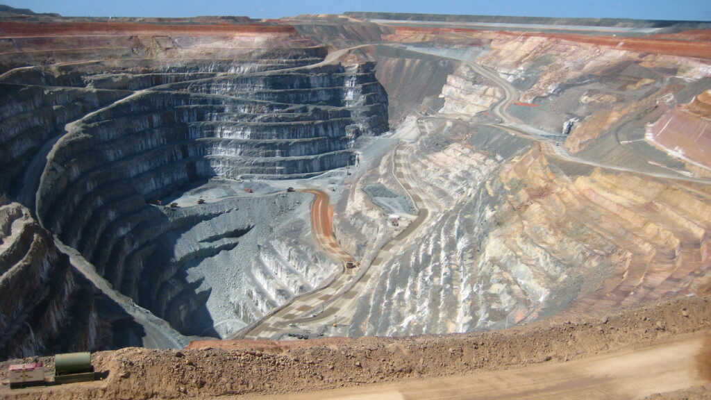
Mining surveyors get involved way before the first blast or excavation even starts, and they’re still there long after production finishes. From feasibility studies and initial pit design all the way through to daily operations, closure, and rehabilitation, their work keeps the whole operation accurate, efficient, and — most importantly — safe.
Every mine has its own personality. Open-pit mines are constantly changing shape: bench heights, haul roads, and highwalls that move every week. Underground mines are even trickier — low visibility, tight headings, dust, vibration, and ground that never behaves exactly like the geological model predicted. That’s why a good mining surveyor needs solid field experience and good judgment, not just fancy gear.
On a typical day you’ll see them setting out drill patterns and blast holes, controlling excavation to stick to design limits, marking conveyor alignments, and doing as-built surveys of underground drives and stopes. They regularly calculate volumes for production reconciliation, measure stockpiles, and run deformation monitoring on pit walls or underground convergence. When they find unexpected voids or old workings, they map them fast — because that information can change the whole plan.
But their real value goes beyond measurements. They sit between the planning engineers, the production supervisors, the geologists, and the safety guys. They manage lease boundaries, keep statutory mine plans updated, and make sure everyone is working from the same reliable set of coordinates — even when dust, water, or poor satellite geometry makes life difficult.
High-precision tools like RTK-GNSS, robotic total stations, laser scanners, and underground positioning systems have changed the game. Surveyors can now work faster and with much better confidence. Still, the most critical part remains the surveyor on site who knows when the numbers look off, when to double-check, and how to make the right call under real mining conditions.
Photogrammetry is the art and science of turning ordinary photographs into accurate, reliable 3D models and measurements of real-world objects and environments.
Whether you need a detailed digital terrain model (DTM) for a construction project, a realistic 3D mesh for volume calculations, an interactive virtual reality tour, or to reconstruct and restore an old building, photogrammetry is often the fastest and most cost-effective solution.
Here’s how it works in practice: You take a large number of overlapping photos of the object or area from different angles. The software then identifies common tie points across the images, calculates their exact position in 3D space, and stitches everything together. These points are connected to form a dense point cloud, which is later turned into a textured mesh or a clean surface model.
Key advantages in engineering and surveying:
Of course, the final quality still depends heavily on good planning: proper image overlap, lighting conditions, and enough ground control points (GCPs) when you need survey-grade accuracy.
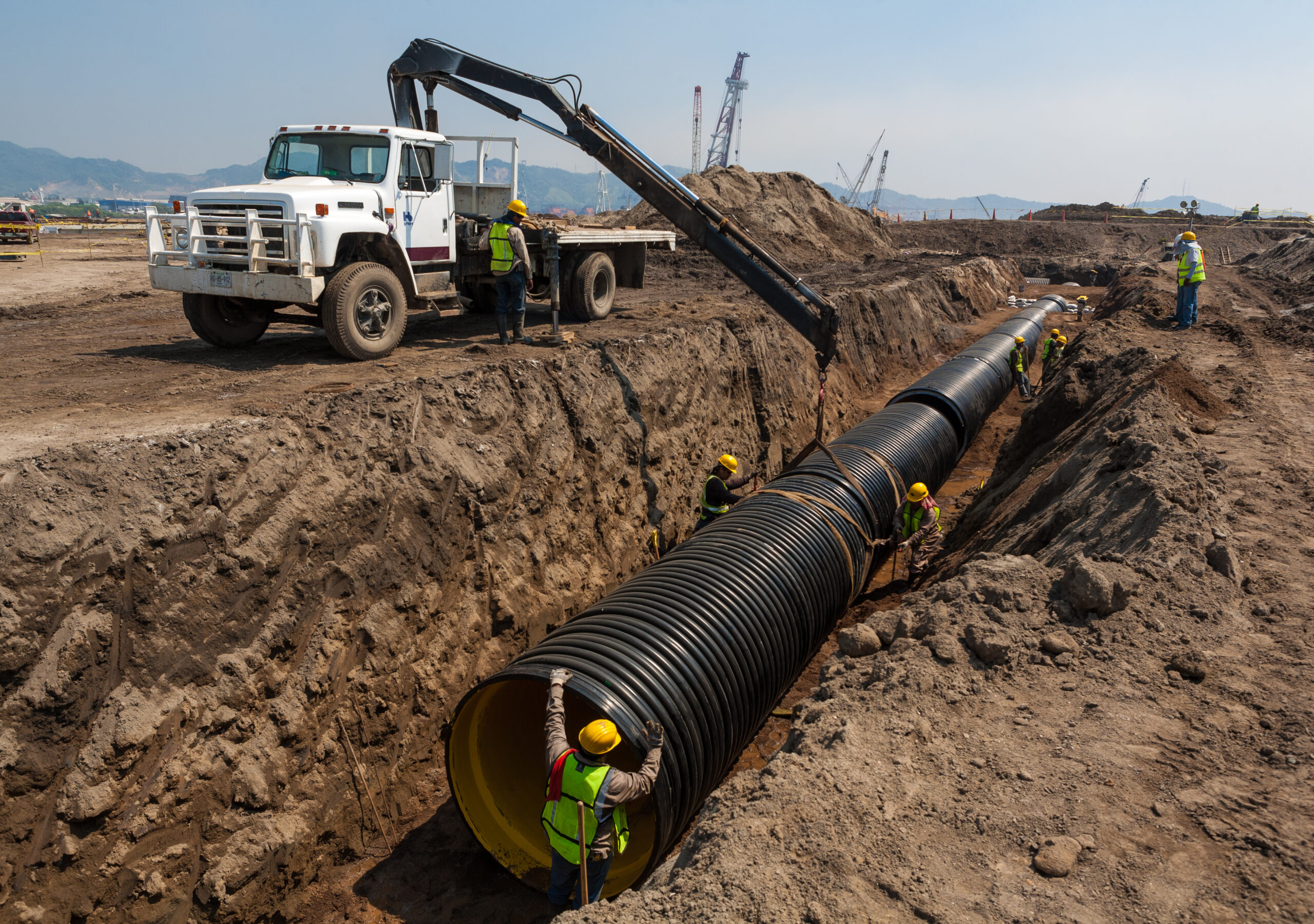
When installing pipelines or burying cables, the alignment decided at the beginning often determines whether a project runs smoothly or becomes a constant source of delays. Small positioning errors can quickly turn into redesign work, clashes with existing utilities, or expensive corrections once construction is already underway — and yes, sometimes you’ll see crews sitting idle for hours while someone double-checks a measurement.
The same challenge appears when locating and documenting existing underground infrastructure. Fibre optic networks, electrical lines, or legacy installations are not always positioned exactly where older drawings suggest. In my experience, surveyors often find surprises — old pipes that were never documented, abandoned conduits, or utilities installed slightly off-plan. Accurate mapping today prevents long troubleshooting sessions years later when maintenance crews need to return to the site.
High-precision positioning supports the entire workflow, including:
Using RTK-GNSS, robotic total stations, or laser scanners, surveyors can stake out alignments in real time, verify depth and separation between utilities, and generate reliable GIS records for future operations. But even with the best tech, it’s the human judgment on site that matters most — knowing when the numbers don’t make sense, when to stop, and when to improvise to avoid costly mistakes.
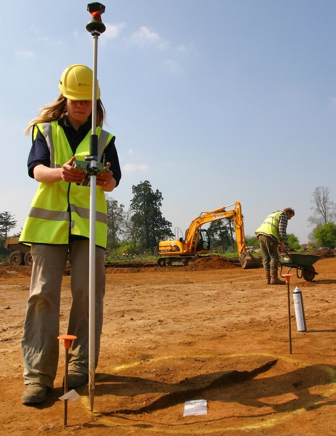
One of the smartest moves you can make when starting a new project is to get a proper topographic survey of the natural ground levels done right at the beginning.
Sure, it feels like an extra expense when you’re still early in the budget. But in my experience, it almost always pays for itself many times over by avoiding nasty surprises later.
With good topo data, you can design the project to actually fit the terrain instead of fighting against it. You can reduce the amount of earthwork dramatically — which means you’ll know the real quantities of cut and fill before you even sign the contract with the excavation subcontractor. No more guessing how many truckloads of material you’ll need or how much it’s really going to cost.
You’ll have a much clearer picture of when you’ll need the machinery, how long the job will take, and where the biggest costs are hiding.
At the end of the day, it’s not just about having nice drawings and pretty contours. It’s about keeping real control of your budget from day one, instead of finding out the hard way once the machines are already working.
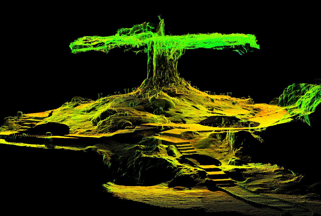
3D laser scanning allows a structure to be captured without physically touching it. Instead of measuring individual points one by one, the scanner records millions of spatial measurements in minutes, creating a detailed digital representation of the environment.
Compared to conventional surveying methods, the main advantage is speed — but also completeness. Complex geometries, irregular surfaces, or hard-to-access areas can be documented in a single session, reducing the need for repeated site visits.
The result is known as a point cloud: a dense collection of spatial data positioned within an X, Y, and Z coordinate system. From this dataset, engineers and designers can extract measurements, generate models, or revisit the site virtually long after fieldwork is finished.
Projects vary widely. Some teams integrate laser scanning into existing surveying workflows, while others use it for renovation planning, structural analysis, or long-term documentation. The approach depends less on the tool itself and more on how precise spatial data fits into the project goals.
If you are evaluating whether this technology makes sense for your workflow, exploring available GNSS and positioning solutions is usually a good starting point — especially when accurate georeferencing becomes important.