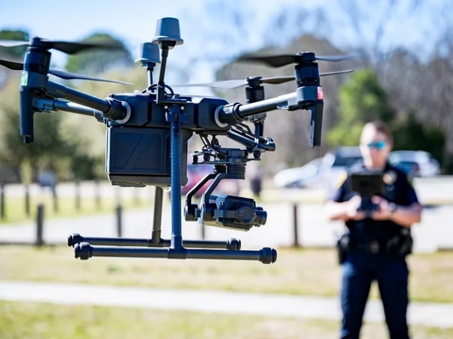
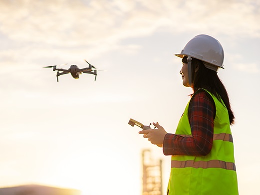
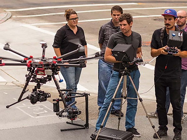
Standard drones are already impressive, but when you equip a UAV with RTK technology, it operates on a completely different level. RTK gives the drone real-time, centimetre-level positioning, turning a simple “flying camera” into a true high-precision tool for surveying and field operations.
Rock-Solid Stability in Every Condition
One of the biggest immediate advantages is flight stability. Normal consumer GPS can drift by several meters, which becomes risky when you’re flying close to buildings, power lines, or valuable crops.
Why RTK Is Becoming the Industry Standard
In professional work — whether it’s construction mapping, forestry, or agriculture — “close enough” simply isn’t good enough anymore. RTK dramatically improves what any UAV can do, making it more capable, more reliable, and significantly safer.
By eliminating GPS drift and providing absolute positioning, you reduce the chance of accidents and ensure that every piece of data you collect is accurate from the very first moment.
In short, RTK isn’t just a nice upgrade — it’s the essential brain that allows a drone to do real professional-grade work in the real world.
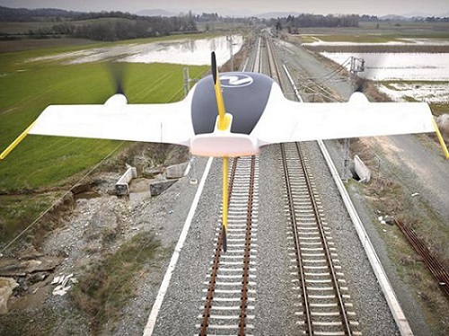
Fixed-wing drones work differently from the usual multi-rotor ones. Instead of relying only on spinning propellers, they use aerodynamic lift like a glider. This design allows them to fly much longer distances and carry heavier payloads, which is why they’ve become the go-to choice for mapping and surveying large areas.
While multi-rotor drones often need frequent battery changes, fixed-wing platforms can stay in the air for hours at a time. That makes large-scale monitoring far more efficient and practical.
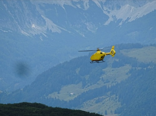
While quadcopters are the most common drones you see, single-rotor drones (essentially unmanned helicopters) are the real workhorses when you need serious power.
A single large rotor gives much more efficient lift than multiple smaller ones. This allows them to carry heavier sensors and payloads and stay in the air longer. That’s why they’re often the best choice for heavy-duty jobs like search and rescue, military reconnaissance, and large-scale agricultural spraying.
The real game-changer comes when you add RTK-GNSS.
With RTK, the drone can hold a rock-steady hover with just 1 cm of accuracy. It almost completely eliminates the drift that usually affects big rotorcraft — even in strong winds or turbulent conditions. This means high-resolution cameras and thermal sensors can capture sharp, reliable data without constant movement.
For professionals who need to lift heavy equipment without sacrificing precision, single-rotor drones are often the most practical solution. They combine serious lifting capacity with the pinpoint accuracy of a much smaller drone, thanks to RTK.
Single-rotor drones (also known as unmanned helicopters) use one large main rotor to generate lift. This design gives them excellent hovering ability and efficient flight in any direction. Thanks to their power and stability, they are the preferred choice for high-stakes search and rescue operations and specialized military missions where performance is critical.
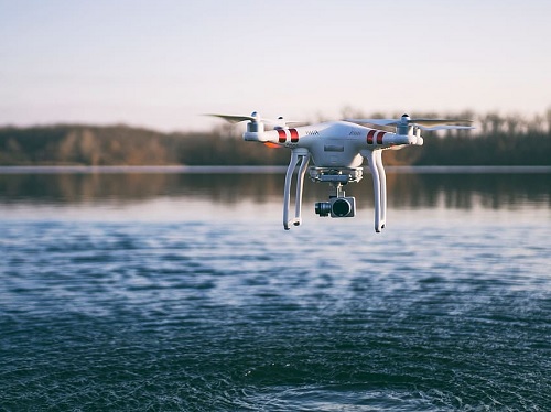
Multi-rotor drones, on the other hand — including tricopters, quadcopters, hexacopters, and octocopters — use three or more rotors to stay in the air. They excel at quick, precise movements, making them easy to fly in tight or complex environments. Because of this agility, multi-rotors have become the global standard for aerial videography and detailed industrial inspections.
In the end, single-rotor drones shine when you need raw lifting power and stability, while multi-rotor drones win when versatility and maneuverability are most important.
Whether you need a helicopter-style UAV for a rescue mission or a nimble quadcopter for a cinematic shot, each design has its own mechanical strengths to get the job done right.
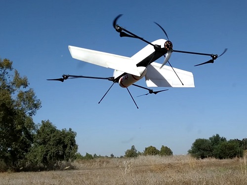
Hybrid drones combine the best of both worlds: the vertical takeoff of multi-rotors and the long-range efficiency of fixed-wing aircraft.
Thanks to their VTOL (Vertical Takeoff and Landing) system, they don’t need runways. They take off like a quadcopter and then transition to forward flight using aerodynamic wings, which greatly extends flight time and reduces battery use.
This makes them ideal for large-scale surveying and mapping over vast areas.
By merging precise landing with long endurance, hybrid drones simplify operations in the field and deliver high-efficiency performance for industrial and agricultural missions.
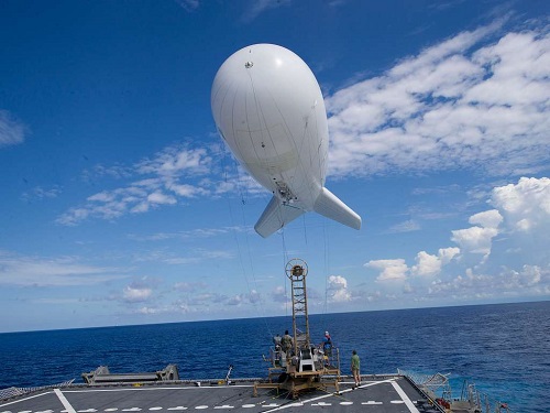
Aerostats are tethered balloons or blimps designed to lift sensors and cameras into the air.
Unlike regular drones that use motors and batteries, aerostats rely on buoyancy to stay aloft. A physical cable connects them to the ground, supplying constant power and a stable data link. This allows them to remain airborne for days or even weeks without landing.
Because they don’t need to recharge or refuel, aerostats are ideal for continuous, long-term monitoring. They provide a steady, uninterrupted aerial view of a specific area — perfect for event security, border surveillance, and environmental monitoring.
By eliminating the energy limitations of traditional drones, aerostats offer a reliable and cost-effective solution for heavy sensor payloads. When you need a persistent “eye in the sky” rather than speed or mobility, an aerostat is often the smartest industrial tool.
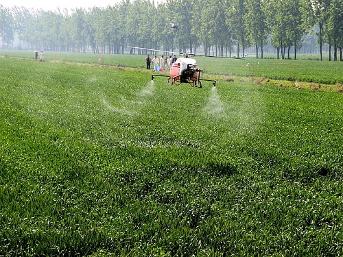
Agriculture drones help farmers automate spraying and seeding while monitoring crop growth in real time.
This automation greatly improves efficiency, leading to higher yields and better overall productivity.
Equipped with advanced sensors, drones quickly create affordable 3D maps that show exactly where crops need water, nitrogen, or other inputs. Farmers can identify problem areas and the best growth zones without guesswork, allowing them to apply resources precisely where they are needed most.
Agricultural applications of spraying drones: precision, efficiency, and sustainability
Construction drones empower project managers to automate site surveying and safety inspections while monitoring structural progress in real-time. This level of automation significantly enhances operational efficiency, leading to streamlined workflows, reduced downtime, and higher overall productivity on-site.
Equipped with high-resolution imaging and LiDAR sensors, these drones rapidly generate accurate 3D point clouds and topographical maps that visualize the exact state of a build. This data allows teams to pinpoint structural discrepancies and safety hazards instantly without the need for manual inspections.
Furthermore, contractors can track material volumes and earthwork progress with high precision. By identifying bottlenecks and high-activity zones without guesswork, they can optimize resource allocation and apply labor or materials precisely where they are required, ensuring projects stay on schedule and within budget.
🔗️ The Role of Drones in Surveying and Monitoring Construction Site
Delivery drones are specialized UAVs designed for the final stage of logistics — the “last-mile” delivery.
By flying directly to the customer and avoiding ground traffic, they offer a faster and more cost-effective way to deliver packages.
They are especially useful for time-sensitive items such as medicine, hot food, and small retail goods that require same-day delivery. Beyond cities, delivery drones are also increasingly used for offshore ship resupply, delivering essential supplies to vessels without the high cost of boats or helicopters.
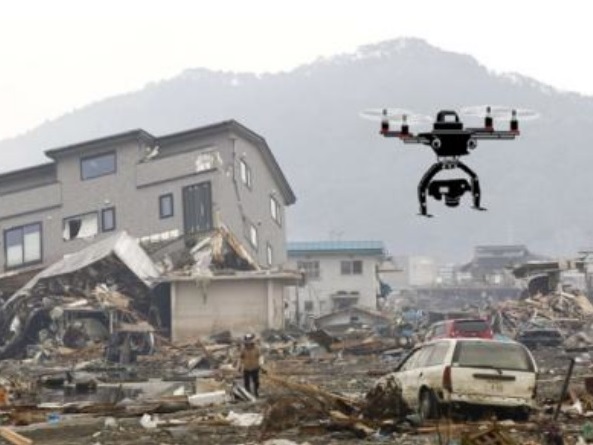
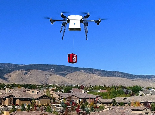
Disaster zone drones deliver critical information and situational awareness when every second counts.
They rapidly survey affected areas, create detailed maps, and identify hazards. This gives first responders the data they need to carry out safer and more effective search and rescue operations. By locating survivors and finding accessible routes, drones help teams direct limited resources exactly where they are most needed.
Beyond mapping, these drones also serve as a vital logistics link. They can quickly deliver food, water, medicine, and fuel to areas cut off by floods, earthquakes, or other disasters — often faster than ground vehicles can reach them. Some advanced models can even help restore communications or provide emergency power.
In modern emergency response, drones have become an indispensable tool for saving time — and lives.
Carrying drones (also known as heavy-lift drones) are designed to transport payloads of different sizes and weights with high precision.
Whether delivering tools to high-rise construction sites or dropping parcels at residential doorsteps, they create a direct aerial route that avoids traffic, roads, and other ground obstacles.
The key to making these heavy-lift operations safe and practical is RTK technology. With centimetre-level accuracy, RTK allows the drone to navigate and deliver payloads exactly where needed — even in tight or cluttered environments.
This precision reduces the need for traditional ground transportation, resulting in faster, more efficient, and more reliable deliveries.
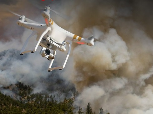
RTK drones equipped with thermal cameras offer a significant advantage in firefighting operations where every second matters.
These drones can quickly scan large areas and identify hotspots even when thick smoke completely blocks the view from the ground. They create detailed aerial maps and accurate 3D models of the fire zone in real time, giving fire commanders clear and precise information to plan their strategy effectively.
This combination of thermal imaging and RTK’s centimetre-level accuracy dramatically improves response times and helps minimize property damage.
Beyond monitoring the fire, these drones also play a vital role in life-saving operations. They help locate trapped victims and assess the structural integrity of buildings before firefighters enter dangerous zones. Some advanced RTK-equipped platforms can even carry fire extinguishing equipment, allowing them to directly suppress flames in areas that are difficult or too risky for ground crews to reach.
By providing both critical intelligence and direct support, RTK thermal drones are becoming an essential tool for modern firefighting teams.
🔗️Firefighting Drones: A Game-Changer for Fire Departments
Forensic drones have become essential tools in modern crime scene investigation, accident reconstruction, and search and rescue operations.
By capturing high-resolution aerial photos and video, these UAVs provide perspectives that are impossible to achieve from the ground. This bird’s-eye view makes it much easier to spot scattered evidence and understand the spatial relationships between objects, vehicles, or people at the scene.
The data collected by forensic drones creates a complete and accurate digital record of the site. Detailed 3D models and aerial maps serve as powerful evidence in court, help resolve insurance claims, and support thorough investigations.
By producing a permanent, high-precision visual archive, forensic drones ensure that no important detail is missed when reconstructing complex events.
🔗️The Critical Role of Ground Control Points and Checkpoints in Drone-Based Scene Investigations
Inspection drones are revolutionizing traditional manual inspections.
They allow teams to collect high-quality data quickly and safely, eliminating the need to climb towers, scaffolding, or enter hazardous areas. This significantly reduces workplace risks and speeds up the entire inspection process.
When equipped with RTK technology, these drones deliver exceptionally accurate results on the condition of buildings, bridges, power lines, and other infrastructure. High-resolution imagery and video can detect fine details such as hairline cracks, corrosion, or structural weaknesses — enabling teams to carry out proactive maintenance before small issues become major problems.
In addition, RTK keeps the drone extremely stable and on a precise flight path, ensuring consistent, repeatable data and minimizing the risk of errors or collisions in confined spaces.
RTK insurance drones are becoming an essential tool for quickly assessing and documenting property damage after storms, floods, or other incidents.
Using high-resolution aerial imagery with centimetre-level accuracy, these drones allow insurance adjusters to see the exact extent of damage from above. This provides clear, objective digital evidence that speeds up the claims process, reduces disputes, and gives both insurers and policyholders a reliable record.
If you’re building a high-precision inspection drone, ArduPilot is one of the most popular open-source flight control softwares. However, many users on the ArduPilot forums struggle when integrating the simpleRTK2B + Heading kit with ArduPlane, ArduCopter, or ArduRover.
After extensive testing, we’ve created a detailed tutorial that walks you through the integration step by step, making the process much smoother and ensuring your RTK system works reliably for insurance inspections.
They provide the precise location data needed to track subtle changes in ecosystems over time. By creating high-resolution land cover and topographical maps, these drones allow scientists to monitor fluctuations in sea levels, river levels, and other critical indicators with centimetre-level accuracy. This reliable data is essential for climate research and flood risk management.
Beyond terrain mapping, RTK-equipped drones also play an important role in wildlife management, particularly in bird control and monitoring. They deliver real-time information on bird activity and flight patterns, enabling researchers and site managers to implement more effective and targeted control measures based on actual movement data.
This high-precision approach ensures that environmental decisions are both efficient and backed by solid, verifiable evidence.
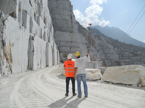
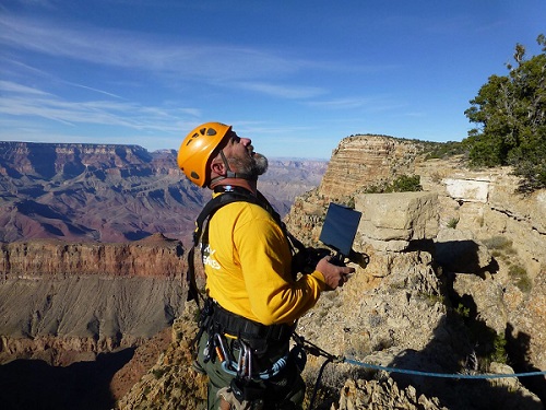
Surveying drones fly over an area equipped with high-quality cameras, LiDAR, or other specialized sensors to collect precise geographic data from above.
Instead of spending days or weeks measuring on the ground, these drones quickly capture high-resolution images and accurate coordinates, making the entire surveying process faster and much more cost-effective.
To ensure complete coverage, the drone follows a planned flight path, systematically flying back and forth across the survey area. While flying, it takes overlapping photos at regular intervals from different angles. This overlap is essential for creating seamless, high-accuracy maps and detailed 3D models, documenting every part of the terrain with professional precision.
Learn more about Survey and Mapping.
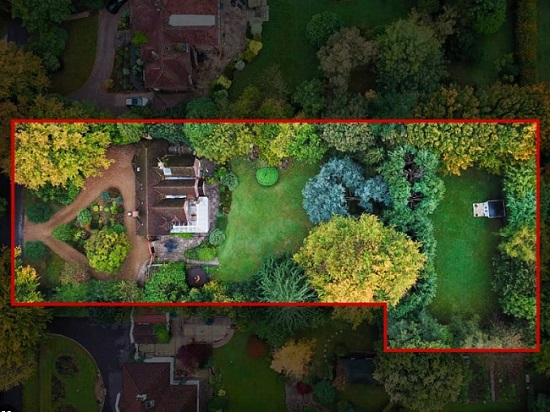
Real estate photography drones have become a must-have tool for selling or renting properties.
By capturing high-quality aerial photos and videos, they show the full scale of the property and its surroundings in a way that ground-level photography simply can’t match. This elevated perspective helps listings stand out in a competitive market, giving potential buyers a clear idea of the layout, size, and curb appeal.
Beyond basic images and videos, these drones are also used to create interactive 3D maps and digital models. Buyers can explore the entire property virtually from their own screen, getting an immersive and detailed view without having to visit in person.
This technology allows real estate agents to provide much more information, helping clients make better decisions and making the whole viewing process faster and smoother.
They provide precise location data and real-time aerial intelligence, helping rescue teams quickly locate missing persons and assess critical situations. This allows teams to move directly to the target with greater efficiency, which can make all the difference when every second counts.
The integration of RTK technology is especially important in these high-stakes operations. It keeps the drone exceptionally stable and accurate, even in bad weather or difficult terrain. This precision improves the effectiveness of the search and significantly increases the safety of the entire operation, giving rescuers reliable information to help save lives in the toughest conditions.
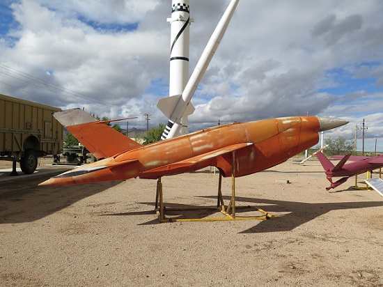
Target drones are specialized UAVs designed to act as realistic aerial targets for training anti-aircraft crews and testing defense systems.
These remote-controlled drones simulate the speed, trajectory, and maneuverability of real enemy aircraft and incoming missiles. By replicating complex flight behaviors, they create a safe but realistic training environment where crews can practice tracking and engaging targets effectively.
Target drones are essential for modern air defense training. Whether simulating short-range threats or high-speed, long-range missiles, they allow military units to test their equipment, validate systems, and improve their accuracy under realistic conditions.
By providing a “live” target for engagement exercises, they help ensure that defense forces are well-prepared to identify and intercept real threats.
The real breakthrough for professional filmmakers and photographers comes with RTK (Real-Time Kinematic) technology.
Standard GPS drones often suffer from small positioning drifts, which can cause jittery movements or inconsistent framing during important shoots. RTK changes that completely by providing centimetre-level accuracy. This allows the drone to hold a perfectly stable position or follow an exact flight path with surgical precision.
Thanks to this extreme stability, directors can execute smooth, complex camera movements and repeat the same shot multiple times with flawless consistency. Whether filming high-end commercials, feature films, or artistic photography, RTK ensures every frame meets the high standards of professional cinematography.
🔗Aerial Cinematography Trends in 2026: The RTK Evolution
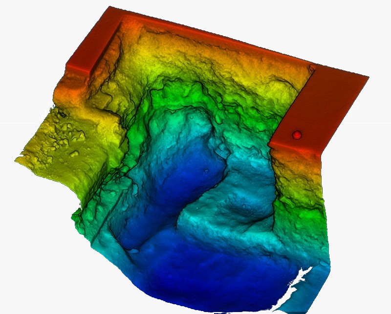
By flying over an area and taking hundreds of overlapping high-resolution photos, these drones allow software to create highly detailed 3D models and accurate maps of terrain, buildings, and structures. What used to require weeks of manual surveying can now be done much faster and with impressive precision.
This technology has become essential for professionals who need a complete, measurable bird’s-eye view of their projects — moving far beyond simple photos into real, actionable spatial data.
The integration of RTK is what takes these drones from good to professional surveying grade.
While standard GPS drones can have positioning errors of several meters, RTK delivers centimetre-level accuracy for every single image. This precision ensures that the final 3D models and topographic maps are geographically correct and reliable.
As a result, RTK photogrammetry drones have become indispensable for land surveying, large-scale construction planning, and detailed environmental monitoring. They create a trustworthy digital twin of any site, allowing exact measurements and confident decision-making without the slow, labor-intensive work of traditional ground surveying.
🔗Accuracy assessment of RTK/PPK UAV-photogrammetry projects
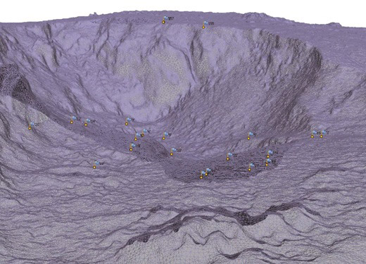
LiDAR drones use advanced laser technology to capture highly detailed 3D data of the environment.
The sensor fires thousands of laser pulses per second and measures how long they take to bounce back. This creates a dense “point cloud” — a precise three-dimensional representation of the terrain, buildings, and vegetation.
Unlike traditional photogrammetry (which relies on photos), LiDAR has a major advantage: it can penetrate through gaps in tree canopies and dense foliage. This allows it to map the true ground surface, even when it’s hidden under trees or thick vegetation.
Thanks to this level of accuracy, LiDAR drones have become essential in many specialized fields:
In short, LiDAR drones deliver reliable, high-resolution 3D data in situations where traditional methods fall short.
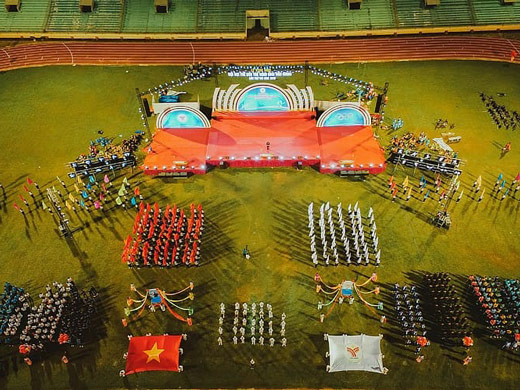
They deliver stable, high-resolution aerial footage perfect for real-time streaming. Whether it’s a large music festival, a high-speed sports event, or a big public celebration, these drones provide unique and immersive perspectives that traditional fixed cameras simply can’t achieve. Thanks to RTK technology, the drone stays rock-steady in the air, giving broadcasters a smooth, professional-grade feed without the jitter or drift common with standard GPS.
But their value goes far beyond just creating great visuals for the audience.
Before the event even starts, RTK drones are used to create highly accurate 3D maps of the venue. This data helps organizers plan critical elements like stage placement, emergency exits, and crowd control barriers. During the event, the real-time aerial view allows security and logistics teams to monitor crowd density and movement, helping them respond quickly and keep everyone safer.
In short, RTK drones combine cinematic streaming with practical planning tools, offering an all-in-one solution for modern event production.