Types of RTK setups used in archaeological fieldwork
RTK handheld with NTRIP (networked corrections) — The simplest and most portable setup. A compact receiver on a pole connects via Bluetooth to your phone or tablet running a GIS app. Corrections come over your mobile data connection from a national network — in most of Europe and North America this service is free or very low cost. Accuracy is 1–2 cm horizontally; the receiver locks a fix in under 30 seconds on a good sky. This setup works well on urban excavations and sites with decent mobile coverage.
Base + rover (local correction link) — For sites in the countryside — hillforts, Roman roads, upland surveys, coastal archaeology — mobile coverage can be patchy or non-existent. A base station receiver placed on a tripod over a known or self-surveyed point transmits corrections to the rover over a UHF radio link, typically effective up to 5–10 km. This is the configuration most relevant to research excavations and landscape projects in remote locations. The ArduSimple Base-Rover Surveyor Kit is built exactly for this scenario.
UAV with RTK or PPK — For photogrammetric site documentation, a drone equipped with an RTK or PPK receiver removes the need to place and survey ground control points before every flight. Each image is tagged with a centimetre-accurate position. The photogrammetry software uses those positions directly to produce a georeferenced orthophoto and 3D model — which can then be used as a base layer for all subsequent recording, planning, and interpretation.
Use cases of RTK GNSS in archaeology
Finds and context recording during excavation
This is the core application and the one that delivers the most immediate benefit. Every object lifted from an excavation, every context boundary drawn, every sample collected — all of it needs a spatial record. With RTK, that record is taken in seconds rather than minutes, and it arrives in your GIS without any intermediate processing step.
The practical difference on a busy excavation is significant. A site with ten trench supervisors recording fifteen to twenty contexts a day in the traditional way ties up a disproportionate amount of time in spatial recording. RTK doesn’t replace the supervisor’s interpretation of what a context is, but it compresses the act of recording it to almost nothing. The same applies to finds: instead of writing “30 cm north of Nail 47, 15 cm below string line,” the object’s position goes directly into the finds register with coordinates that have meaning outside the four walls of that specific trench.
There is also a durability argument. Site datums get disturbed, string lines get knocked, pegs get pulled. A GPS coordinate referenced to a global datum exists independently of anything that happens to your physical site infrastructure. For long-running excavations that span multiple seasons, this independence from local benchmarks is genuinely valuable.
Research reference: Internet Archaeology — Integrating RTK GPS into excavation recording systems
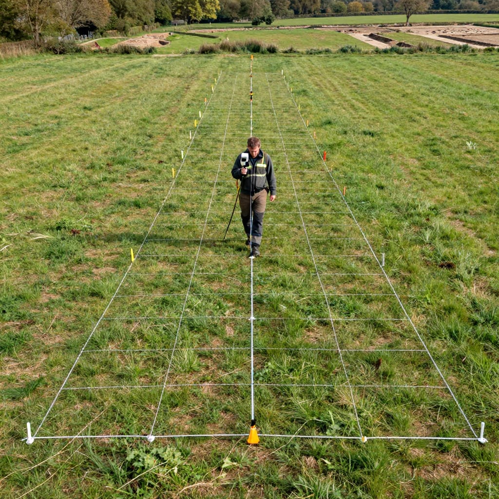
Pre-excavation geophysical survey — grid layout and instrument positioning
Magnetometry, ground-penetrating radar, earth resistance survey — all of these methods require operators to walk precise, evenly spaced transects across a survey area while recording instrument readings at fixed intervals. The accuracy of the resulting anomaly map depends directly on how accurately those transect positions were maintained.
The traditional approach involves hammering out a grid of canes every 10 or 20 metres across the survey area, then navigating between them with the instrument. On a smooth flat field this is manageable; on irregular terrain, through crops, or across a site with multiple access constraints, it becomes a significant logistical exercise that can take longer than the survey itself.
With an RTK receiver feeding real-time position to the geophysical instrument’s logger, the operator simply walks and the system records both readings and coordinates simultaneously. There are no canes to set out, no grid to establish, and no accumulated drift from corner to corner of the survey block. The position data can also be used post-survey to flag areas where the operator deviated from the planned transect — a quality check that is very difficult to apply to conventionally gridded surveys.
The resulting anomaly maps are georeferenced directly into the project GIS alongside excavation data, aerial photographs, and archival cartography — without the reprojection exercise that consumes so much time when grids and coordinate systems don’t align.
Research reference: Archaeological Prospection — GPS-guided geophysical survey: accuracy and practical implications
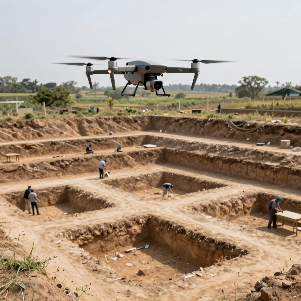
UAV photogrammetry for site documentation
The overhead site photograph used to require a scaffold tower, a telescopic pole camera, or a hired aircraft. Now a drone can do it in ten minutes, and with RTK it can do it to centimetre accuracy without any ground control points at all.
The workflow is straightforward. A UAV equipped with an RTK or PPK receiver flies a pre-planned grid over the excavation. Each photo is tagged with the camera’s exact position at the moment of capture. The photogrammetry software — Pix4D, Agisoft Metashape, OpenDroneMap — processes the images into a georeferenced orthomosaic and a dense 3D point cloud. Those outputs load directly into QGIS or ArcGIS as a base layer accurate to 2–5 cm per pixel, depending on flight height.
What this changes for archaeology is the frequency and completeness of spatial documentation. Flying an RTK drone over a site at the end of each week costs almost nothing once the equipment is in place. That means you can build a time-stamped record of site development that would have been prohibitively expensive to commission with traditional aerial photography — and you can do it without ground control setup, which is often the slowest part of UAV survey work on excavations.
The 3D point cloud has its own uses: measuring section profiles, calculating spoil volumes, documenting complex stratigraphic relationships in three dimensions without having to draw them by hand. For sites with architectural remains or substantial earthwork features, this is a qualitative step up from a hand-drawn plan.
Research reference: Journal of Archaeological Science — UAV photogrammetry in archaeological survey: evaluation of accuracy without ground control
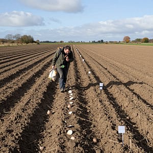
Field walking and surface collection surveys
 Surface survey — walking ploughed fields in systematic lines, collecting and bagging artefacts by grid square — is one of the most labour-intensive methods in the archaeologist’s toolkit and, paradoxically, one of the hardest to do well spatially. When twenty people are walking 50-metre intervals across a 10-hectare field in an October drizzle, maintaining a precise grid and recording each collection point accurately is genuinely difficult.
RTK changes the spatial accuracy of the exercise without changing the human effort required for the survey itself. Each collector carries a receiver — or works in pairs with one receiver between them — and their position is logged continuously or at collection events. The artefact density distribution that emerges from the analysis is accurate to the path actually walked, not the path that was intended.
For large-scale landscape survey projects, the difference this makes to interpretability is real. Density peaks that look meaningful might turn out to reflect a section of field where walkers bunched up slightly, or a transect that drifted 8 metres to one side. Accurate position data makes those artefacts visible; without it, they’re buried in the noise.
Research reference: Journal of Field Archaeology — The role of GPS accuracy in surface collection data quality
Landscape and monument survey
The most rewarding RTK application in archaeology, and arguably the most underused, is the survey of earthwork monuments and landscape features. A team of two people with an RTK handheld can survey the earthwork profile of a hillfort, the extent of a medieval field system, or the topography of a barrow cemetery in a morning — producing a DTM (digital terrain model) that captures relief to 2–3 cm vertical accuracy.
Comparable data has historically required either a total station (accurate but slow) or an airborne LiDAR dataset (accurate but expensive and not always available at the resolution needed). RTK ground survey sits in a useful middle space: more accurate than consumer-grade GPS tracks, faster than total station work, and entirely under the project team’s control.
For English and Welsh heritage contexts, data at this accuracy level can feed directly into designation assessments, conservation management plans, and scheduled monument consent applications. Historic England’s own guidance on archaeological survey explicitly recognises centimetre-grade GPS positioning as appropriate for most monument survey tasks — a recognition that the technology has matured well beyond its early limitations.
Research reference: Historic England — Metric Survey Specifications for Cultural Heritage (PDF)
Site boundary definition and planning submissions
Archaeology interacts with the planning system constantly — through desk-based assessments, watching briefs, evaluation trenches, and mitigation excavations required as conditions of planning permission. All of this involves spatial data that must meet a standard acceptable to local authority archaeologists, planning inspectors, and heritage bodies.
RTK provides that standard. A site boundary surveyed with an RTK receiver produces a shapefile or GeoJSON polygon with coordinate accuracy in the 1–2 cm range, tied to the national grid, and accompanied by accuracy metadata. This is the same spatial standard used by professional land surveyors, and it’s directly importable into the GIS systems used by local planning authorities.
In practice, this matters most when the boundary of an Area of Archaeological Interest, a scheduled monument buffer zone, or an area requiring mitigation overlaps with a proposed development footprint. Disputes about whether a development is inside or outside a defined zone — which have historically been difficult to resolve when different parties were using different GPS devices with different accuracies — become straightforward when the original data was collected to centimetre accuracy.
Research reference: Chartered Institute for Archaeologists — Standards and Guidance for Archaeological Field Evaluation
Georeferencing historical maps and archival plans
Archaeology generates and uses enormous quantities of historical cartographic material — OS maps from different periods, estate maps, tithe maps, town plans, excavation records going back to the nineteenth century. Making that material spatially useful in a modern GIS requires it to be georeferenced accurately: warped and stretched to align with real-world coordinates using control points whose positions are known precisely.
RTK provides those control points cleanly. Features visible on a historical map that still have physical counterparts on the ground — a building corner, a road junction, a prominent earthwork — can be surveyed with a centimetre-accurate fix and used as georeferencing control points. The more control points you have, and the more accurate they are, the better the resulting warp will be.
This also works in reverse for archival excavation plans. A site where work was done in the 1970s, with plans drawn at 1:20 and referenced to a site grid that no longer exists, can be brought into a modern GIS if there are identifiable features that survive both in the original drawing and in the present landscape. RTK positions on those features give you the control you need. For research projects building on previous excavation records, this is often the foundational step before any new fieldwork can begin.
Research reference: Internet Archaeology — Georeferencing and integrating legacy excavation records into GIS

 Surface survey — walking ploughed fields in systematic lines, collecting and bagging artefacts by grid square — is one of the most labour-intensive methods in the archaeologist’s toolkit and, paradoxically, one of the hardest to do well spatially. When twenty people are walking 50-metre intervals across a 10-hectare field in an October drizzle, maintaining a precise grid and recording each collection point accurately is genuinely difficult.
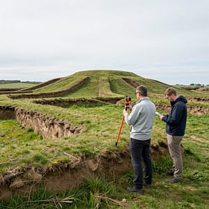 The most rewarding RTK application in archaeology, and arguably the most underused, is the survey of earthwork monuments and landscape features. A team of two people with an RTK handheld can survey the earthwork profile of a hillfort, the extent of a medieval field system, or the topography of a barrow cemetery in a morning — producing a DTM (digital terrain model) that captures relief to 2–3 cm vertical accuracy.
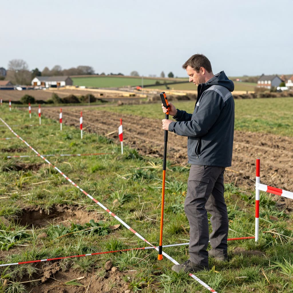 Archaeology interacts with the planning system constantly — through desk-based assessments, watching briefs, evaluation trenches, and mitigation excavations required as conditions of planning permission. All of this involves spatial data that must meet a standard acceptable to local authority archaeologists, planning inspectors, and heritage bodies.
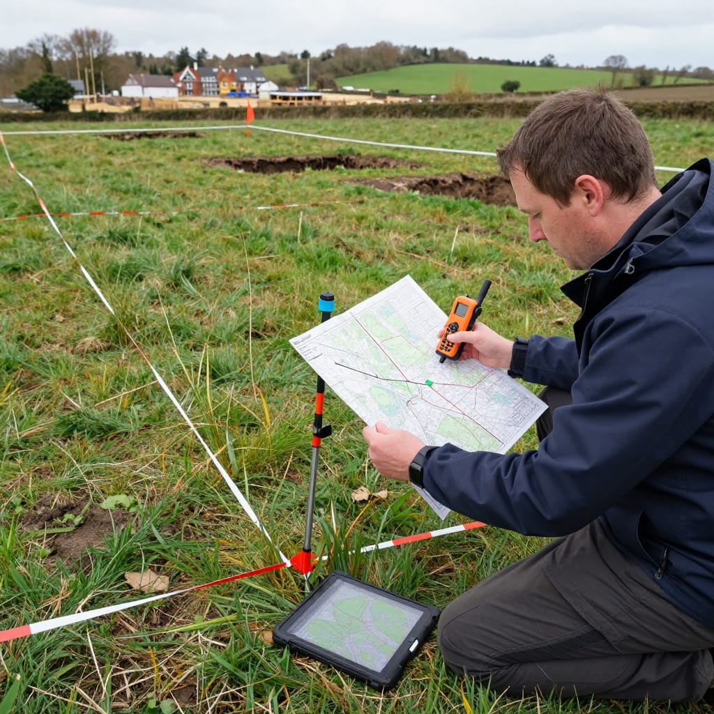 Archaeology generates and uses enormous quantities of historical cartographic material — OS maps from different periods, estate maps, tithe maps, town plans, excavation records going back to the nineteenth century. Making that material spatially useful in a modern GIS requires it to be georeferenced accurately: warped and stretched to align with real-world coordinates using control points whose positions are known precisely.