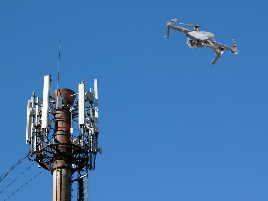
An unmanned aerial vehicle (UAV), commonly known as a drone, is an aircraft that can fly without the onboard presence of pilots.
RTK technology can improve the performance of various types of drones and unmanned aerial vehicles (UAVs) by providing precise and accurate navigation data, improve the ability to maintain a stable position in the air, even in windy conditions.
Overall, RTK technology can enhance the capabilities of drones and UAVs, making them more effective and reliable for a range of applications.
Types of drones
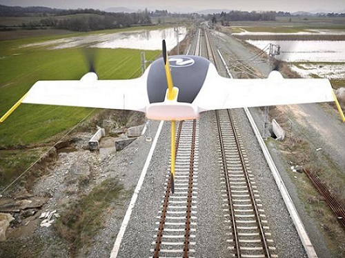
Fixed-wing drone
Fixed-wing drones (gliders or sailplanes) have wings that provide lift and allow them to fly long distances while carrying heavy payloads. They are ideal for tasks such as mapping, surveying, and monitoring large areas.
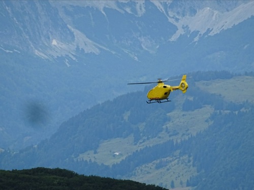
Single-rotor drone
Single-rotor drones, also known as helicopters, have one large rotor that provides lift, allowing them to hover in place and fly in any direction. They are commonly used in search and rescue operations and for military applications.
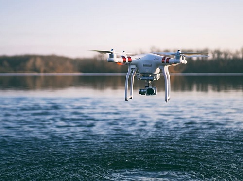
Multi-rotor drone
Multi-rotor drones (tricopters, quadrotors, hexacopters, octocopters) have 3 or more rotors that provide lift and allow for quick, precise maneuvering. They are widely used for aerial videography and inspection tasks.
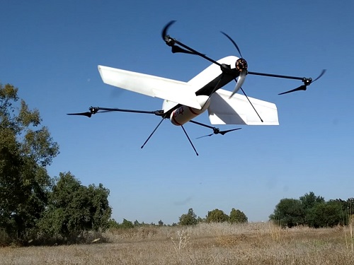
Hybrid drone
Hybrid drones combine the features of fixed-wing and multi-rotor drones, allowing them to take off and land vertically like multi-rotor drones but also fly like fixed-wing drones. These drones are often used for long-distance surveying and mapping tasks.
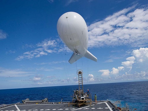
Aerostat
Aerostat is a type of drone that uses a tethered balloon or blimp to lift a payload of sensors or cameras into the air.
Use cases of RTK drones
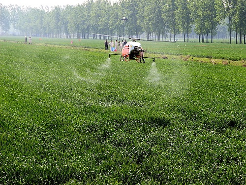
Agriculture
Agriculture drones help farmers automate crop spraying and seeding, monitor and inspect crop growth and improve farming efficiency, leading to increased outputs and maximising productivity. Drones can produce 3D maps, quickly and cheaply, which help farmers make important decisions about seed-planting pattern design and nitrogen-level management, for example. Drones equipped with monitoring equipment can identify areas of the field experiencing lack of water or monitor the best areas for growth. Explore more precision agriculture use cases.
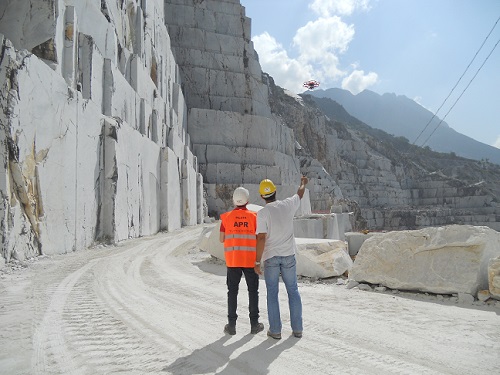
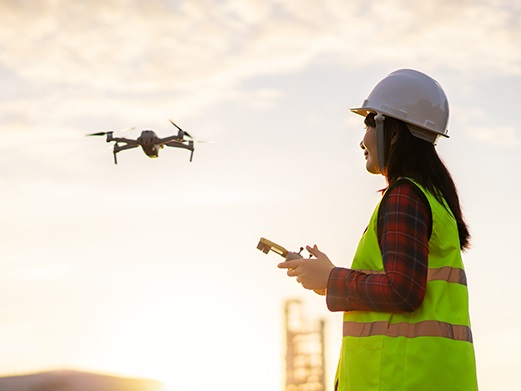
Construction
Construction drones can be used for a variety of purposes, including surveying, mapping, and monitoring construction sites. With high-resolution cameras and other sensors, these drones can provide detailed imagery and data to aid in project planning and management, improve safety by conducting inspections in hazardous or hard-to-reach areas, reducing the need for workers to access those areas directly.
Delivery
A delivery drone is a type of unmanned aerial vehicle (UAV) used for distributing packages to consumers during the last mile delivery process. The current most popular use cases for delivery drones are time-sensitive materials such as medicine, food, small items for same-day delivery, as well as ship offshore resupply.
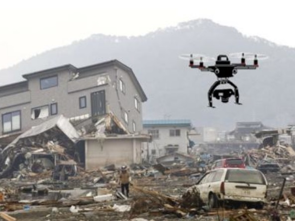
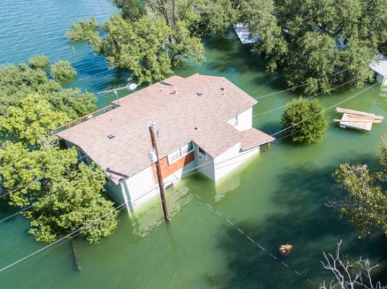
Disaster zone
Disaster zone drones are used to provide critical data and situational awareness in disaster response operations. They can quickly and efficiently survey disaster zones, creating detailed maps and identifying potential hazards. This data assists first responders in their search and rescue operations, help to identify survivors, and inform the allocation of resources. Drones can bring food, fuel, water, supplies, medicine, communications, and even electricity to areas hard hit by natural or man-made disasters faster and more efficiently than any other platform.
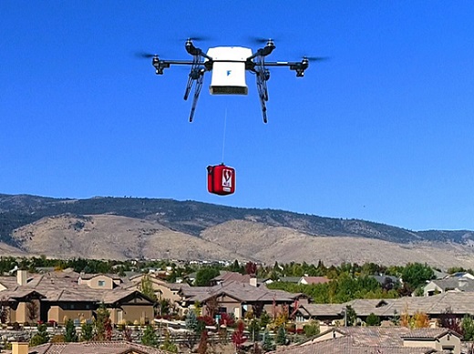
Carrying
Carrying drones are used for carrying payloads of varying sizes and weights with precision and accuracy. These drones transport equipment or tools to construction sites, or delivering parcels to residential areas. The precise navigation provided by RTK technology ensures that the drones can deliver payloads safely and efficiently, reducing the need for ground-based transportation.
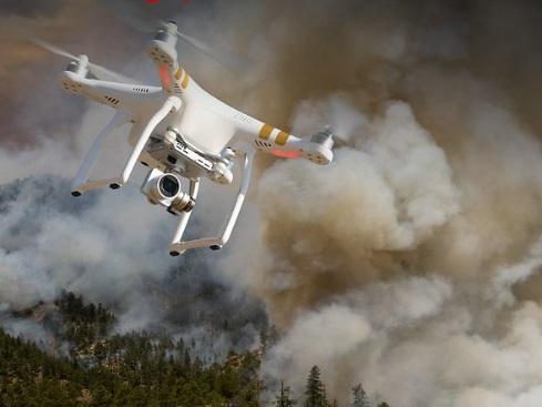
RTK drones equipped with thermal cameras can quickly identify hotspots, map the spread of fires and create detailed aerial maps of the fire zone. This real-time data and 3D maps can help firefighters to plan and execute their strategies more effectively, improving their response times and reducing property damage. RTK drones assist in locating victims or assessing structural damage, helping to inform rescue operations and ensure the safety of first responders. Equipped with fire extinguishing equipment, a drone put out fires.
Forensic
Forensic drones have several use cases in the field of crime scene investigation, accident reconstruction, and search and rescue operations. These drones provide aerial images and videos of the scene, helping investigators identify evidence and reconstruct events. This data can be used in court proceedings, insurance claims or other investigations.
Inspection
Inspection drones are transforming manual inspection processes, allowing inspectors to speed up their collection of inspection data while removing slower manual steps that place them in danger.
RTK drones inspects to provide accurate data on the condition of infrastructure such as buildings, bridges and power lines. The high-resolution images and videos captured by these drones can identify potential issues such as cracks, corrosion, or other forms of damage, allowing for proactive maintenance and repair. Additionally, RTK technology can ensure that the drones maintain a stable and consistent flight path, providing accurate data and reducing the risk of errors.
Insurance
RTK insurance drones are used to assess and document property damage for insurance claims. The high-resolution aerial imagery provided by these drones can be used to identify and document the extent of damage, which can expedite the claims process.
Many of our customers use Ardupilot for creating RTK drone. Looking at the official Ardupilot forum we found many users having problems configuring simpleRTK2B+heading kit with their ArduPlane / ArduCopter / ArduRover software. After some testing we prepared this tutorial to make the process easier.
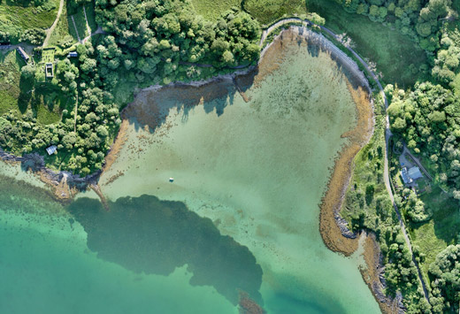
Environment monitoring
RTK GPS drones are particularly useful in environmental monitoring as they provide precise and accurate location data. This data is used to create high-resolution cover maps or topographical maps, to monitor changes in sea or river levels, which are important indicators of environmental health. RTK drones are used for bird control monitoring by providing real-time data on bird activity and behavior, allowing for effective and efficient bird control measures to be implemented.
Surveying
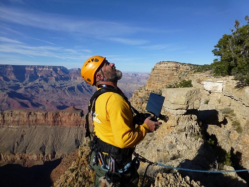
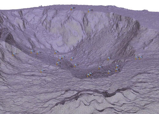
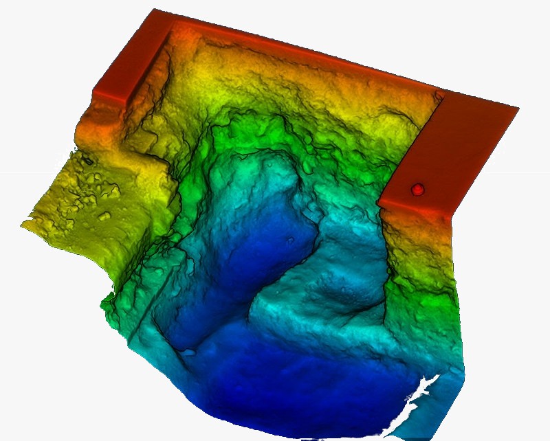
Surveying drones fly over a defined area with sensors pointing toward the earth. They collect high-resolution images and geographic coordinates with professional cameras, LiDAR, or other kinds of sensors. Typically, the drone flies over the area in a predefined survey pattern, taking overlapping photos at intervals from several angles.
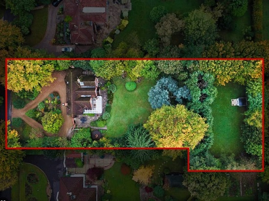
Real estate photography
Real estate photography drones are used to provide aerial footage of properties for sale or rent. Real estate photography drones create 3D maps and models of the property, providing potential buyers with a comprehensive view of the property. Check out 3D survey use case.
Search and rescue
Search and rescue drones are used in operations to provide precise and accurate location data of missing persons or emergency situations. The real-time data provided by a drone helps rescuers navigate to the location quickly and efficiently, potentially saving lives. RTK technology can ensure that the drones remain stable and responsive in challenging conditions, allowing for safer and more effective rescue operations.
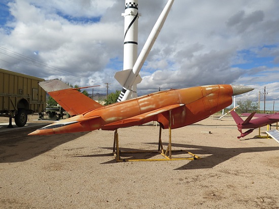
Target drone
A target drone is an unmanned aerial vehicle, generally remote controlled, usually used in the training of anti-aircraft crews. Target drones perform the function of an aerial target that simulates the behavior of missile systems of different ranges for both tracking and engagement in all air defense scenarios. Such drones are used as training aids for missile systems.
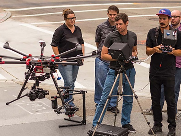
Photography and Videography
The drones provide stable and high-quality aerial footage in photography and videography. The precise positioning and stabilization provided by RTK technology ensure smooth and accurate camera movements, allowing for professional-grade cinematography.
Photogrammetry
The photogrammetry drones create detailed maps or 3D models using aerial imagery. With RTK technology, these drones achieve high levels of accuracy and precision, allowing for the creation of highly detailed and accurate maps and models. This makes them particularly useful for applications such as land surveying, construction planning, and environmental monitoring.
Lidar
LiDAR drones use laser technology to collect high-resolution 3D maps of the environment, providing accurate and precise data on terrain, vegetation, and other features. These drones are particularly useful in surveying and mapping applications, as well as in environmental monitoring and disaster response. LiDAR drones can also be used in construction and engineering projects to assess site conditions and plan infrastructure development.
Live streaming
RTK drones can be used to capture aerial footage for live streaming events such as concerts, sports events or festivals. The high-resolution footage and stable camera platform provided by RTK technology can provide unique and immersive views for audiences. A drone can create 3D maps of the event location for planning and logistics purposes.
If you are a DIY person, we have prepared easy tutorials to accelerate your DIY drone development: